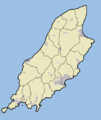
File:Isle Of Man Outline Map.png
Click on a date/time to view the file as it appeared at that time.
| Date/Time | Thumbnail | Dimensions | User | Comment | |
|---|---|---|---|---|---|
| current | 22:11, 17 August 2007 |  | 600 × 714 (348 KB) | Jza84 | {{Information |Description=A Map of the Isle of Man. Black lines show the Manx parishes. |Source=self-made |Date=August 2007 |Author= Jhamez84 }} |
File usage
No pages on the English Wikipedia use this file (pages on other projects are not listed).
Global file usage
The following other wikis use this file:
- Usage on de.wikipedia.org
- Usage on eu.wikipedia.org
- Douglas
- Laxey
- Castletown
- Peel (Man uhartea)
- Ramsey (Man uhartea)
- Txantiloi:Kokapen mapa/Man
- Ballasalla
- Ballaugh
- Braaid
- Cregneash
- Derbyhaven
- Foxdale
- Glen Maye
- Onchan
- Port St Mary
- Port Erin
- Andreas (Man Uhartea)
- Ballabeg
- Ballure (Man uhartea)
- Barregarrow
- Colby (Man Uhartea)
- Crosby (Man Uhartea)
- Dalby (Man Uhartea)
- Glen Vine
- Niarbyl (Man uhartea)
- Newtown (Man Uhartea)
- Port Soderick
- Ronague
- St John's (Man uhartea)
- Strang (Man uhartea)
- Sulby (Man Uhartea)
- Tromode
- Union Mills
- Ayre
- Glenfaba
- Garff
- Michael (sheading)
- Middle (sheading)
- Rushen (sheading)
- Andreas (parrokia)
- Arbory (parrokia)
- Ballaugh (parrokia)
- Braddan
- Bride (parrokia)
- German (parrokia)
- Jurby
- Lezayre
- Lonan (parrokia)
- Malew
View more global usage of this file.