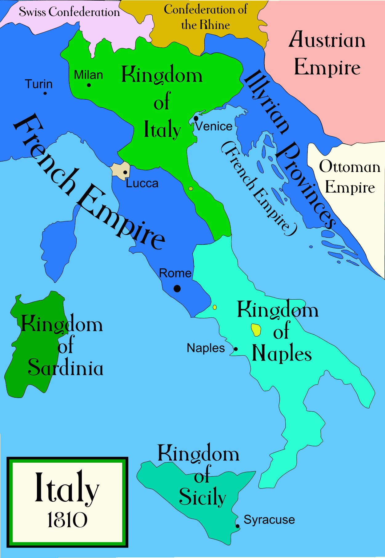
File:Italy C 1810.png
Political map of Italy in the years around 1810, during the Napoleonic era, created by MapMaster. This is a companion map to Image:Italy 1796.png and Image:Italy 1494_v2.png. An SVG version of this map (with Slovenian labels) can be found at Image:Italija_1810_Slovenscina.svg.
Spanish version: File:Italy c 1810-es.png, uploaded by Aibdescalzo

|
This historical map image could be re-created using vector graphics as an SVG file. This has several advantages; see Commons:Media for cleanup for more information. If an SVG form of this image is available, please upload it and afterwards replace this template with
{{vector version available|new image name}}.
It is recommended to name the SVG file “Italy c 1810.svg”—then the template Vector version available (or Vva) does not need the new image name parameter. |
References
- Bjorklund, Oddvar; Holmboe, Haakon; Rohr, Anders (1970) Historical Atlas of the World, Barnes & Noble, NY, SBN: 389-00253-4.
- Other maps, including Image:1french-empire1811.jpg from the 1912 Cambridge Modern History Atlas.
Licensing
I, the copyright holder of this work, hereby publish it under the following licenses:

|
Permission is granted to copy, distribute and/or modify this document under the terms of the GNU Free Documentation License, Version 1.2 or any later version published by the Free Software Foundation; with no Invariant Sections, no Front-Cover Texts, and no Back-Cover Texts. A copy of the license is included in the section entitled GNU Free Documentation License. |
| This file is licensed under the Creative Commons Attribution-Share Alike 3.0 Unported license. | ||
| ||
| This licensing tag was added to this file as part of the GFDL licensing update. |
You may select the license of your choice.
derivative works
Derivative works of this file:
[]
-
 Arabic
 -
 English
 -
 Spanish
 -
 Korean


