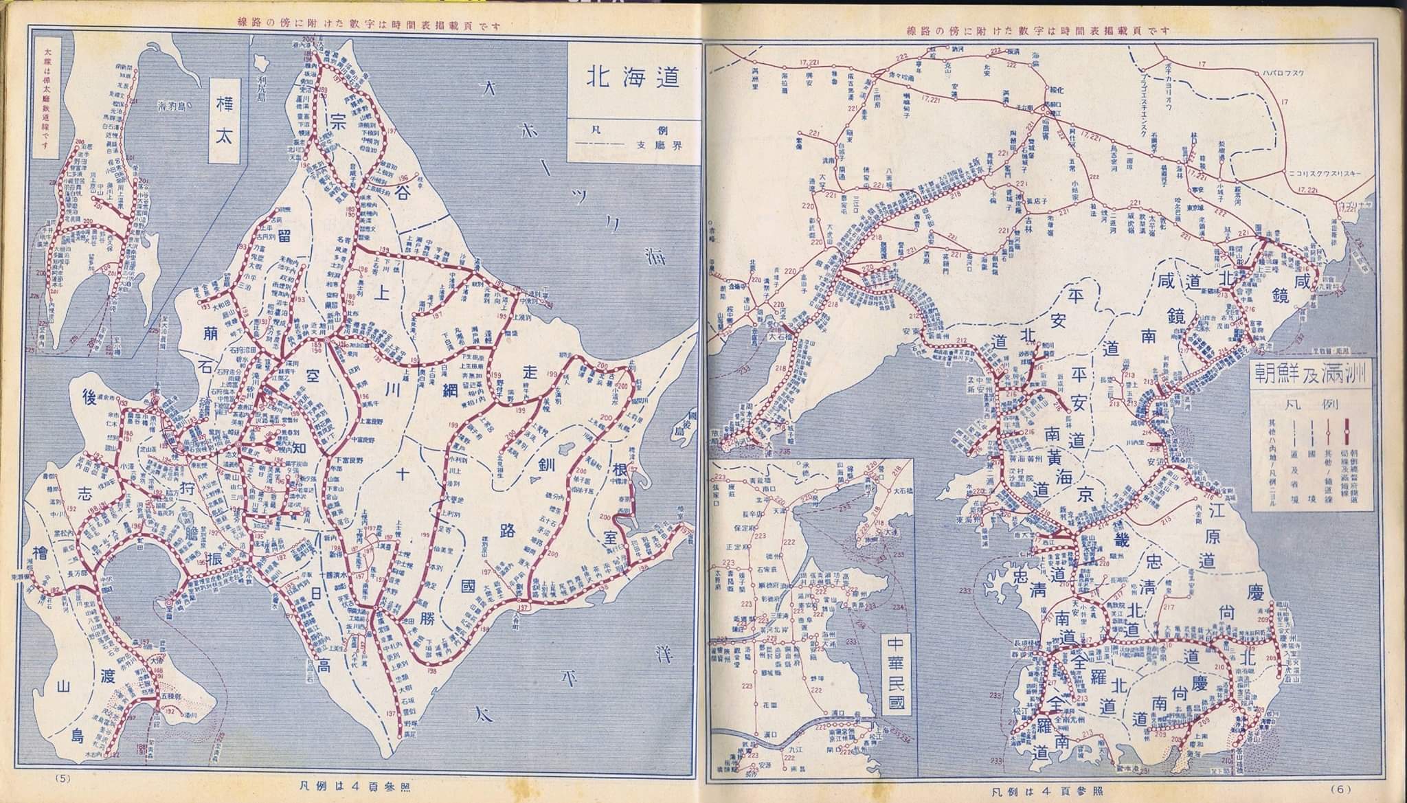
File:Japanese Government Railways Wartime Route Map.jpg
العربية ∙ беларуская (тарашкевіца) ∙ čeština ∙ Deutsch ∙ Ελληνικά ∙ English ∙ español ∙ français ∙ Bahasa Indonesia ∙ italiano ∙ 日本語 ∙ 한국어 ∙ македонски ∙ Nederlands ∙ português ∙ русский ∙ sicilianu ∙ slovenščina ∙ ไทย ∙ Tiếng Việt ∙ 中文(简体) ∙ 中文(繁體) ∙ +/−
 Flag of the United States Flag of the United States
| Japanese Government Railways map of Hokkaido, Chosen, Karahuto, and Manchuko
홋카이도, 조선, 가라후토, 만주국 내 일본국유철도 노선도
北海道、朝鮮、樺太、と満州国の戦前日本政府鉄道地図
北海道、朝鮮、樺太、和満州国的戰前日本政府鐵路地圖
Click on a date/time to view the file as it appeared at that time.
| Date/Time | Thumbnail | Dimensions | User | Comment |
|---|
| current | 22:29, 25 August 2021 |  | 2,048 × 1,169 (373 KB) | Lexcie | Uploaded a work by Japanese Government Railways from Scanner--Collection of Nobuyuki Kuribayashi with UploadWizard |
The following pages on the English Wikipedia use this file (pages on other projects are not listed):
The following other wikis use this file:
- Usage on de.wikipedia.org
- Usage on ja.wikipedia.org
- Usage on ms.wikipedia.org
This file contains additional information, probably added from the digital camera or scanner used to create or digitize it.
If the file has been modified from its original state, some details may not fully reflect the modified file.