https://creativecommons.org/publicdomain/mark/1.0/PDMCreative Commons Public Domain Mark 1.0falsefalse
Captions
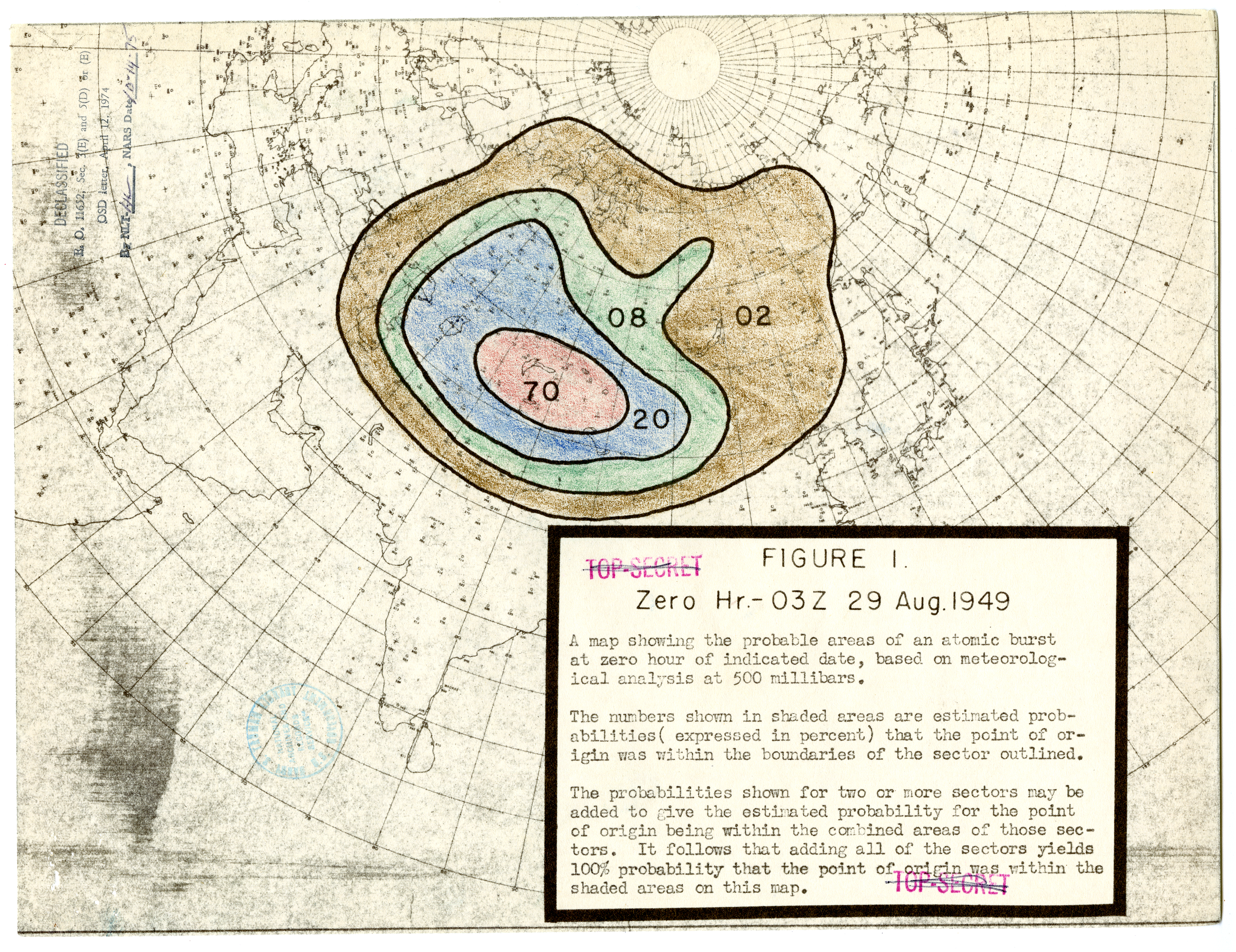
This chart from September 1949 shows the United States Weather Bureau's prediction for where the Soviet Union first tested its atomic bomb in 1949. Each colored zone indicates the probability that the bomb was detonated within that area.
Uploaded a work by United States Weather Bureau from [https://catalog.archives.gov/id/310987319?objectPage=7 US National Archives website]: Harry S. Truman Presidential Library, Collection HST-PSF: President's Secretary's Files (Truman Administration), Series: Subject Files, File Unit: National Security Council - Atomic File, 1945-1952: Atomic Bomb: Reports: "Report, United States Weather Bureau Report on Alert Number 112 of the Atomic Detection System." with UploadWizard
File usage
The following pages on the English Wikipedia use this file (pages on other projects are not listed):