Click on a date/time to view the file as it appeared at that time.
| Date/Time | Thumbnail | Dimensions | User | Comment |
|---|
| current | 18:53, 6 February 2017 | 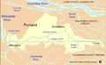 | 698 × 425 (325 KB) | Jeanjung212 | Lossless Compressed/optimized png decreasing file size by 46311 bytes |
| 20:35, 30 April 2008 | 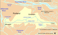 | 698 × 425 (371 KB) | Finetooth | == Summary == {{Information |Description= Map of Johnson Creek (Willamette River) watershed in Multnomah County and Clackamas County, Oregon, United States |Source= Taken from U.S. Census website [http://factfinder.census.gov/home/saff/main.html?_lang=en] |
| 03:56, 30 April 2008 | 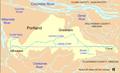 | 698 × 425 (370 KB) | Finetooth | == Summary == {{Information |Description= Map of Johnson Creek (Willamette River) watershed in Multnomah County and Clackamas County, Oregon, United States |Source= Taken from U.S. Census website [http://factfinder.census.gov/home/saff/main.html?_lang=en] |
| 01:31, 28 April 2008 | 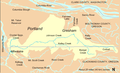 | 698 × 425 (374 KB) | Finetooth | == Summary == {{Information |Description= Map of Johnson Creek (Willamette River) watershed in Multnomah County and Clackamas County, Oregon, United States |Source= Taken from U.S. Census website [http://factfinder.census.gov/home/saff/main.html?_lang=en] |
| 03:29, 26 April 2008 | 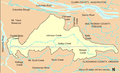 | 698 × 425 (80 KB) | Finetooth | {{Information |Description= Map of Johnson Creek (Willamette River) watershed in Multnomah County and Clackamas County, Oregon, United States |Source= Taken from U.S. Census website [http://factfinder.census.gov/home/saff/main.html?_lang=en] and modified |


