File:Jupiter Lightnings.jpg
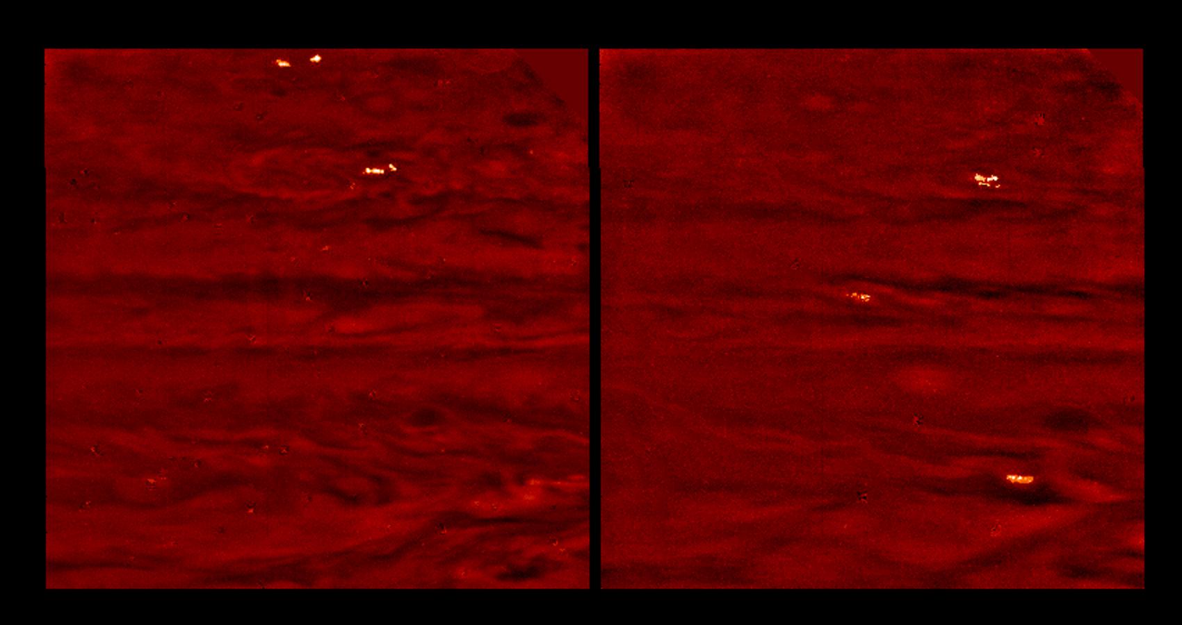
The moonlight from Io allows the lightning storms to be correlated with visible cloud features. The latitude bands where the storms are seen seem to coincide with the "disturbed regions" in daylight images, where short-lived chaotic motions push clouds to high altitudes, much like thunderstorms on Earth. The storms in these images are roughly one to two thousand kilometers across, while individual flashes appear hundreds of kilometer across. The lightning probably originates from the deep water cloud layer and illuminates a large region of the visible ammonia cloud layer from 100 kilometers below it.
There are several small light and dark patches that are artifacts of data compression. North is at the top of the picture. The images span approximately 50 degrees in latitude and longitude. The lower edges of the images are aligned with the equator. The images were taken on October 5th and 6th, 1997 at a range of 6.6 million kilometers by the Solid State Imaging (SSI) system on NASA's Galileo spacecraft.


