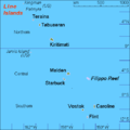
File:KI Line Islands.PNG
Click on a date/time to view the file as it appeared at that time.
| Date/Time | Thumbnail | Dimensions | User | Comment | |
|---|---|---|---|---|---|
| current | 09:29, 27 August 2007 |  | 500 × 500 (8 KB) | Hobe | {{Information |Description=map Line Islands, Kiribati |Source=own work, composed from various mapreferences |Date=2007-08-08 |Author=Holger Behr Category:Maps of Kiribati }} |
File usage
The following 6 pages use this file:
Global file usage
The following other wikis use this file:
- Usage on ar.wikipedia.org
- Usage on bg.wikipedia.org
- Usage on bn.wikipedia.org
- Usage on br.wikipedia.org
- Usage on cs.wikipedia.org
- Usage on da.wikipedia.org
- Usage on de.wikipedia.org
- Kingmanriff
- Kiritimati
- Palmyra (Atoll)
- Line Islands
- Tabuaeran
- Teraina
- Jarvisinsel
- Caroline-Atoll
- Malden (Insel)
- Starbuck (Insel)
- Vostok (Insel)
- Flint (Insel)
- Filippo (Riff)
- Vorlage:Navigationsleiste Inseln und Atolle der Line Islands
- Abaiang (Teraina)
- Kauamwemwe
- Uteute
- Kaaitara
- Tangkore
- Matanibike
- Arabata
- Mwakeitari
- Onauea
- Betania (Tabuaeran)
- Tereitake
- Napari
- Aontenaa
- Terine (Tabuaeran)
- Tereitannano
- Aramari (Kiribati)
- Fareturaina
- Usage on el.wikipedia.org
- Usage on en.wiktionary.org
- Usage on eo.wikipedia.org
- Usage on es.wikipedia.org
- Usage on eu.wikipedia.org
- Usage on fa.wikipedia.org
- Usage on fi.wikipedia.org
- Usage on frr.wikipedia.org
- Usage on fr.wikipedia.org
- Usage on gl.wikipedia.org
View more global usage of this file.