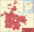
File:Karte Niederbayern-Landshut Und Oberbayern.png
own work, used:
Author
Lencer
- Die vier Herzogtümer nach der Teilung von 1392, Haus der Bayrischen Geschichte (HDBG)
- Bayern-Ingolstadt, Haus der Bayrischen Geschichte (HDBG)
- Minimap created with Heiliges Römisches Reich um 1400.svg by Lencer
- Generic Mapping Tools

|
This map has been made or improved in the German Kartenwerkstatt (Map Lab). You can propose maps to improve as well.
|
The map has been created with the Generic Mapping Tools: https://www.generic-mapping-tools.org/ using one or more of these public-domain datasets for the relief:
|

|
Permission is granted to copy, distribute and/or modify this document under the terms of the GNU Free Documentation License, Version 1.2 or any later version published by the Free Software Foundation; with no Invariant Sections, no Front-Cover Texts, and no Back-Cover Texts. A copy of the license is included in the section entitled GNU Free Documentation License. |
| This file is licensed under the Creative Commons Attribution-Share Alike 3.0 Unported license. | ||
| ||
| This licensing tag was added to this file as part of the GFDL licensing update. |


