Click on a date/time to view the file as it appeared at that time.
| Date/Time | Thumbnail | Dimensions | User | Comment |
|---|
| current | 19:21, 3 November 2013 |  | 2,065 × 1,614 (2.12 MB) | Chumwa | |
| 07:38, 3 November 2013 |  | 2,065 × 1,614 (2.13 MB) | Chumwa | |
| 15:31, 2 November 2013 |  | 2,065 × 1,638 (2.15 MB) | Chumwa | |
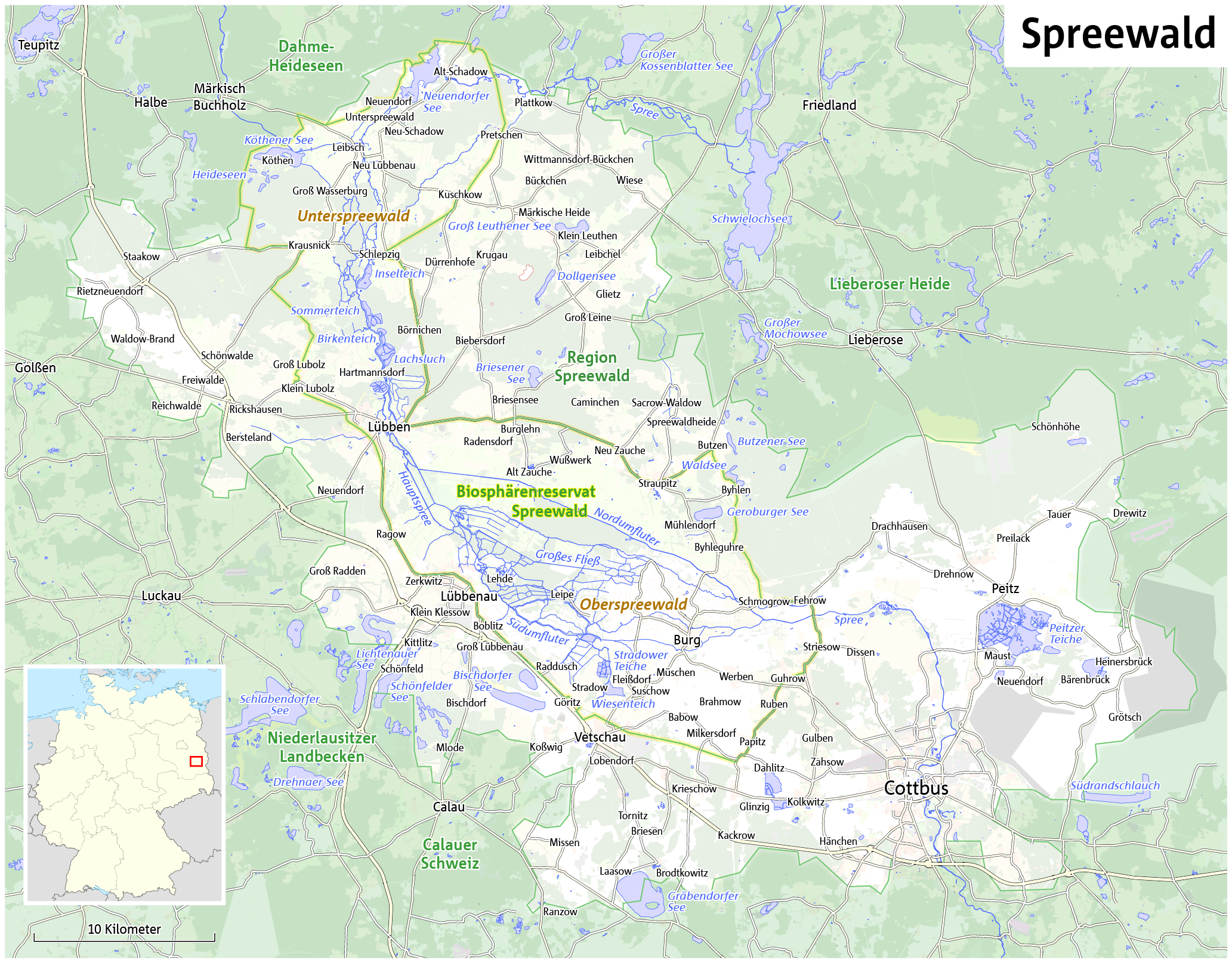
| 07:02, 2 November 2013 |  | 2,065 × 1,638 (2.16 MB) | Chumwa | == {{int:filedesc}} == {{Information |Description= {{de|Karte des Spreewaldes}} {{en|Map of the Spreewald region}} |Author=Maximilian Dörrbecker (Chumwa) |Source={{own}}, using OpenStreetMap data for the ba... |
The following pages on the English Wikipedia use this file (pages on other projects are not listed):
The following other wikis use this file:
- Usage on af.wikipedia.org
- Usage on azb.wikipedia.org
- Usage on cs.wikipedia.org
- Usage on da.wikipedia.org
- Usage on de.wikipedia.org
- Usage on de.wiktionary.org
- Usage on dsb.wikipedia.org
- Usage on en.wikivoyage.org
- Usage on eo.wikipedia.org
- Usage on es.wikipedia.org
- Usage on fa.wikipedia.org
- Usage on fr.wikipedia.org
- Usage on he.wikipedia.org
- Usage on hsb.wikipedia.org
- Usage on it.wikipedia.org
- Usage on ja.wikipedia.org
- Usage on ko.wikipedia.org
- Usage on mk.wikipedia.org
- Usage on nl.wikipedia.org
- Usage on no.wikipedia.org
- Usage on pl.wikipedia.org
- Usage on pl.wikivoyage.org
- Usage on sv.wikipedia.org
- Usage on th.wikipedia.org
- Usage on uk.wikipedia.org
- Usage on www.wikidata.org
This file contains additional information, probably added from the digital camera or scanner used to create or digitize it.
If the file has been modified from its original state, some details may not fully reflect the modified file.


