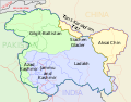
File:Kashmir Map.svg
Own work
International Borders: University of Texas map library - India Political map 2001
Disputed Borders: University of Texas map library - China-India Borders - Eastern Sector 1988 & Western Sector 1988 - Kashmir Region 2004 - Kashmir Maps.
State and District boundaries: Census of India - 2001 Census State Maps - Survey of India Maps.
Other sources: US Army Map Service, Survey of India Map Explorer, Columbia University
Map specific sources: [1],.
Author
w:user:Planemad
Permission
(Reusing this file)
Other versions
SVG development 

International Borders: University of Texas map library - India Political map 2001
Disputed Borders: University of Texas map library - China-India Borders - Eastern Sector 1988 & Western Sector 1988 - Kashmir Region 2004 - Kashmir Maps.
State and District boundaries: Census of India - 2001 Census State Maps - Survey of India Maps.
Other sources: US Army Map Service, Survey of India Map Explorer, Columbia University
Map specific sources: [1],.
(Reusing this file)
![]() The frontiers depicted on the Indian maps in Wikipedia are from a neutral point of view and may differ from official government maps of India, Pakistan and China. Please consult local laws governing publication of maps before usage.
The frontiers depicted on the Indian maps in Wikipedia are from a neutral point of view and may differ from official government maps of India, Pakistan and China. Please consult local laws governing publication of maps before usage.
[]
-
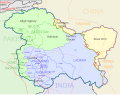
 Old Original Map
 -
 অসমীয়া
 -
 বাংলা
বাংলা -
 中文
中文 -
 English
 -
 हिन्दी
 -
 español
 -
 कॉशुर / کٲشُر
 -
 اردو
اردو
.svg)


Others
-
 2020 skirmish
 -
 2019 Balakot airstrike


This map was created with Adobe Illustrator.
Licensing
I, the copyright holder of this work, hereby publish it under the following license:
This file is licensed under the Creative Commons Attribution-Share Alike 3.0 Unported license.
- You are free:
- to share – to copy, distribute and transmit the work
- to remix – to adapt the work
- Under the following conditions:
- attribution – You must give appropriate credit, provide a link to the license, and indicate if changes were made. You may do so in any reasonable manner, but not in any way that suggests the licensor endorses you or your use.
- share alike – If you remix, transform, or build upon the material, you must distribute your contributions under the same or compatible license as the original.


![[1]](http://www.mapsofindia.com/maps/jammuandkashmir/jammu-and-kashmir-map.jpg)