File:Kebira Crater.jpg
Courtesy of Boston University Center for Remote Sensing
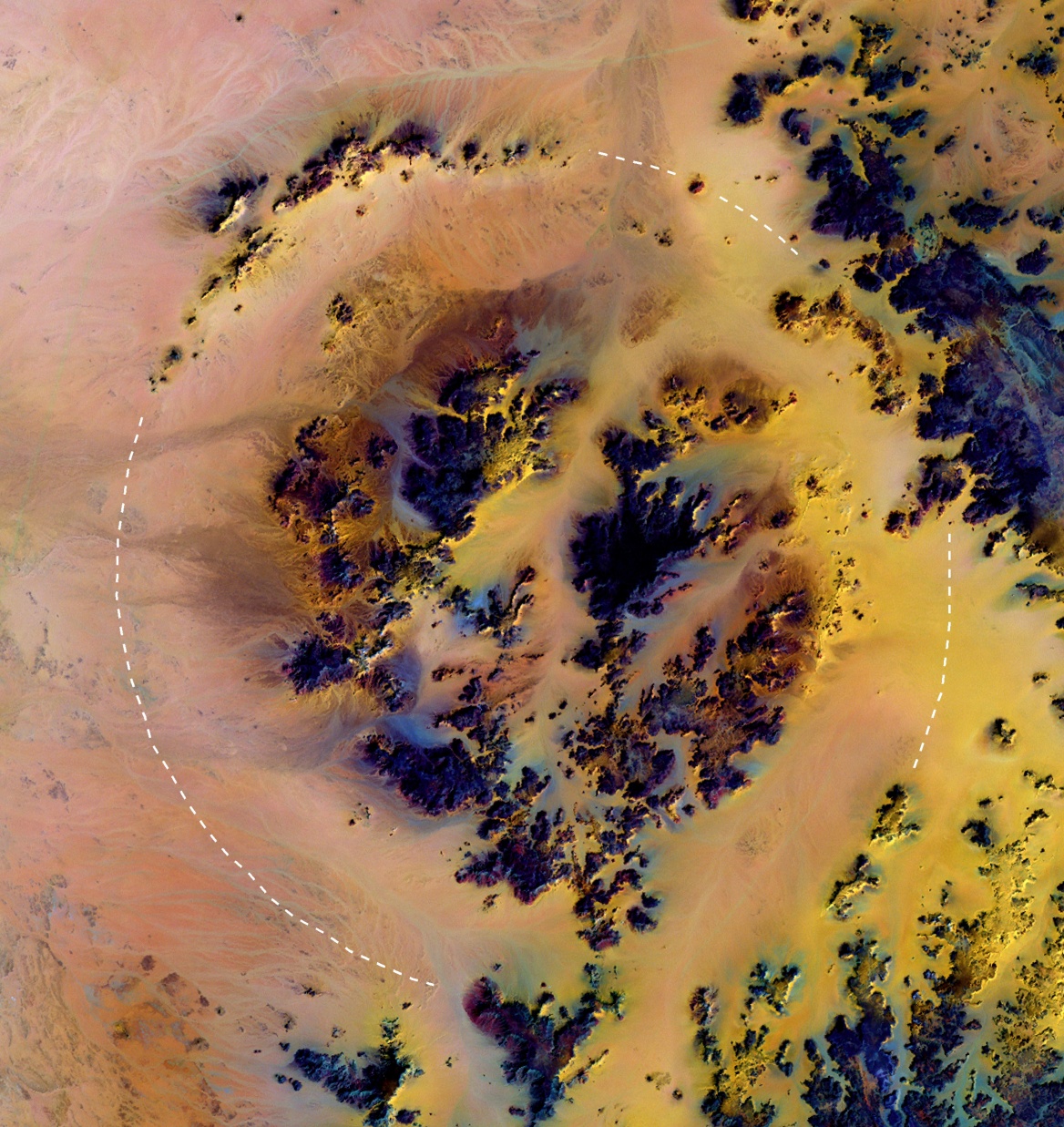
Deutsch: Landsat Farbkompositbild des Kebira-Kraters in der Westlichen Wüste Ägyptens. Der äußere Rand hat 31 km Durchmesser, angedeutet durch die kreisförmige gestrichelte Kurve.
Licensing
| This file is in the public domain in the United States because it was solely created by NASA. NASA copyright policy states that "NASA material is not protected by copyright unless noted". (See Template:PD-USGov, NASA copyright policy page or JPL Image Use Policy.) | ||
 |
Warnings:
|

![[2]](ftp://crsftp.bu.edu/pub/crs/kebira/bu_web_color.jpg)