File:Kerguelen Map.png
Click on a date/time to view the file as it appeared at that time.
| Date/Time | Thumbnail | Dimensions | User | Comment | |
|---|---|---|---|---|---|
| current | 13:04, 16 October 2008 | 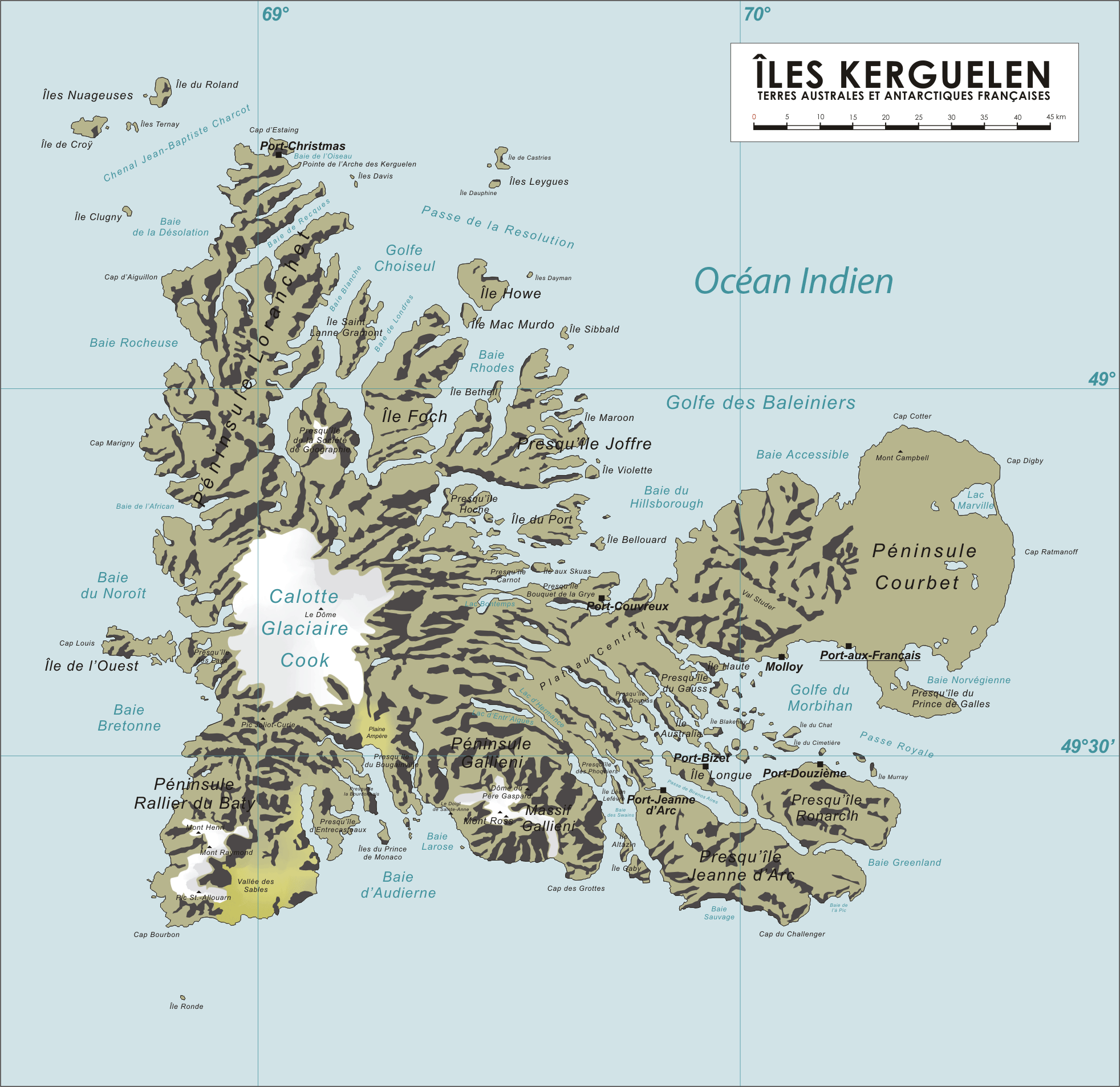 | 1,964 × 1,906 (337 KB) | Ralf Roletschek | {{Information |Description= |Source= |Date= |Author= |Permission= |other_versions= }} |
| 07:40, 13 April 2006 |  | 1,964 × 1,906 (904 KB) | Varp~commonswiki | ||
| 07:41, 12 April 2006 |  | 1,964 × 1,906 (866 KB) | Varp~commonswiki | ||
| 10:14, 9 April 2006 |  | 1,964 × 1,906 (866 KB) | Varp~commonswiki | ||
| 14:52, 8 April 2006 |  | 1,964 × 1,906 (853 KB) | Varp~commonswiki | *Map of the Kerguelen Islands, French Southern and Antarctic Territories *drawn by varp |
File usage
The following pages on the English Wikipedia use this file (pages on other projects are not listed):
Global file usage
The following other wikis use this file:
- Usage on als.wikipedia.org
- Usage on ar.wikipedia.org
- Usage on da.wikipedia.org
- Usage on de.wikipedia.org
- Usage on de.wikivoyage.org
- Usage on de.wiktionary.org
- Usage on el.wikipedia.org
- Usage on es.wikipedia.org
- Usage on et.wikipedia.org
- Usage on fi.wikipedia.org
- Usage on frr.wikipedia.org
- Usage on fr.wikipedia.org
- Usage on gag.wikipedia.org
- Usage on gl.wikipedia.org
- Usage on hr.wikipedia.org
- Usage on hu.wikipedia.org
- Usage on id.wikipedia.org
- Usage on ie.wikipedia.org
- Usage on is.wikipedia.org
- Usage on ka.wikipedia.org
- Usage on lt.wikipedia.org
- Usage on nds.wikipedia.org
- Usage on nn.wikipedia.org
- Usage on no.wikipedia.org
- Usage on pl.wikipedia.org
- Usage on pnb.wikipedia.org
- Usage on ro.wikipedia.org
- Usage on sk.wikipedia.org
- Usage on sr.wikipedia.org
- Usage on sv.wikipedia.org
- Usage on ug.wikipedia.org
- Usage on uk.wikipedia.org
- Usage on ur.wikipedia.org
- Usage on vi.wikipedia.org
- Usage on war.wikipedia.org
- Usage on zh.wikipedia.org