File:LB And SCRly Map 204 (cropped).jpg
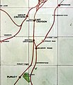
At the centre of the image on the right is a station entrance. Go in there and look to your left. You will see a ceramic map of the whole of the LB&SCR network. A few steps further on and also on the left is this map. (Some of you have walked past it many times and never seen it!)
The map key describes Bingham Road, Spencer Road and Bandon as "motor halts". The green 'V' below Sanderstead marks a golf club, presumably Purley Downs GC.
Licensing
|
This is a faithful photographic reproduction of a two-dimensional, public domain work of art. The work of art itself is in the public domain for the following reason:
The official position taken by the Wikimedia Foundation is that "faithful reproductions of two-dimensional public domain works of art are public domain". This photographic reproduction is therefore also considered to be in the public domain in the United States. In other jurisdictions, re-use of this content may be restricted; see Reuse of PD-Art photographs for details. {{PD-Art}} template without license parameter: please specify why the underlying work is public domain in both the source country and the United States
(Usage: {{PD-Art|1=|deathyear=''year of author's death''|country=''source country''}}, where parameter 1= can be PD-old-auto, PD-old-auto-expired, PD-old-auto-1996, PD-old-100 or similar. See Commons:Multi-license copyright tags for more information.) | ||||
but for the ruling cited above, I would licence this as my own work with Roger W Haworth's licence.

