Loading
  • 21 Aug, 2019

  • By, Wikipedia

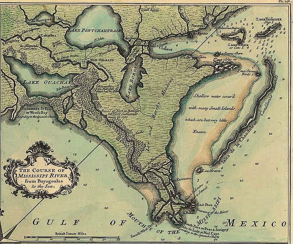
File:Lake Borgne De La Tour Map 1720.jpg

Detail of the map from the de la Tour survey of 1720 as published in 1759, showing the New Orleans area with Lake Borgne, Lake Pontchartrain Basin, and lower Missisissippi River.

Copyright expired.

Related Image: Image:New Orleans de la Tour map 1720 1759.jpg Full published version of De la Tour survey map


Licensing

Public domain

This work is in the public domain in its country of origin and other countries and areas where the copyright term is the author's life plus 70 years or fewer.


You must also include a United States public domain tag to indicate why this work is in the public domain in the United States.

File history

Click on a date/time to view the file as it appeared at that time.

Date/TimeThumbnailDimensionsUserComment
current06:25, 30 September 2014Thumbnail for version as of 06:25, 30 September 20141,158 × 966 (398 KB)Gwillhickerslarger image, better color tone and clarity
16:34, 9 May 2006Thumbnail for version as of 16:34, 9 May 2006656 × 547 (249 KB)InfrogmationDetail of the map from the de la Tour survey of 1720 as published in 1759, showing the New Orleans area with Lake Borgne, Lake Pontchartrain Basin, and lower Missisissippi River. Copyright expired. Category:Lake Pontchartrain [[Category:Maps of
The following pages on the English Wikipedia use this file (pages on other projects are not listed):

Global file usage

The following other wikis use this file:

Metadata