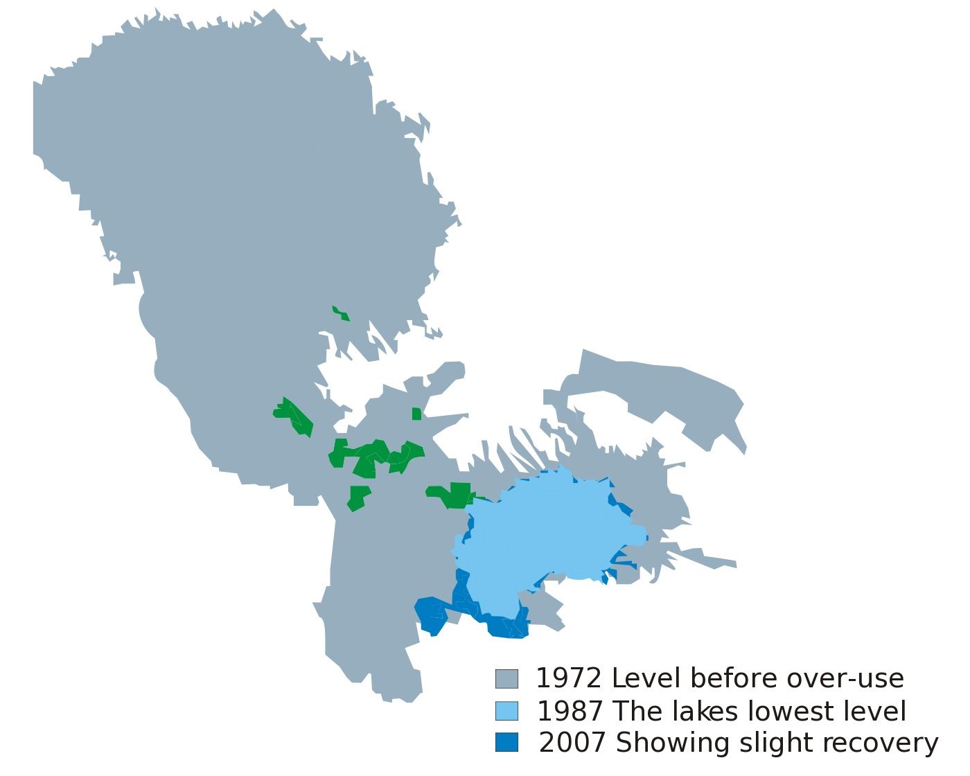
File:Lake Chad.jpg
| This is a retouched picture, which means that it has been digitally altered from its original version. Modifications: cut some portion of the file. The original can be viewed here: Lake Chad map showing receding water area and level 1972-2007.svg:
|
Licensing
| I, the copyright holder of this work, release this work into the public domain. This applies worldwide. In some countries this may not be legally possible; if so: I grant anyone the right to use this work for any purpose, without any conditions, unless such conditions are required by law. |
Original upload log
This image is a derivative work of the following images:
- File:Lake_Chad_map_showing_receding_water_area_and_level_1972-2007.svg licensed with PD-self
- 2010-02-28T04:33:44Z Chaosdruid 2440x1373 (157736 Bytes) Correcting area displayed to full instead of A4 cutoff
- 2010-02-28T04:29:38Z Chaosdruid 744x1052 (140458 Bytes) {{Information |Description=Blank map of Africa{{ValidSVG}} |Source=*[[:File:Blank_Map-Africa.svg|]] |Date=2010-02-28 04:27 (UTC) |Author=*[[:File:Blank_Map-Africa.svg|]]: [[User:Andreas 06|Andreas 06]] *derivative work: ~~~ |
Uploaded with derivativeFX
