File:Langlois And Van Gogh Bridges Locations Map.gif
Click on a date/time to view the file as it appeared at that time.
| Date/Time | Thumbnail | Dimensions | User | Comment | |
|---|---|---|---|---|---|
| current | 09:56, 5 November 2008 | 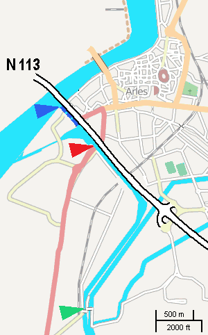 | 300 × 482 (20 KB) | W. | {{Information |Description= |Source= |Date= |Author= |Permission= |other_versions= }} |
| 12:07, 4 November 2008 |  | 300 × 482 (20 KB) | W. | {{Information |Description={{en|1=This rough map, adapted from a screenshot from OSM, shows locations of ''Langlois bridge'' (red) and today's ''Van Gogh bridge'' (green). Dark blue shows the channel entrance as of 1888.}} |Source=self, using a screenshot |
File usage
The following pages on the English Wikipedia use this file (pages on other projects are not listed):
Global file usage
The following other wikis use this file:
- Usage on de.wikipedia.org
- Usage on eo.wikipedia.org
- Usage on fr.wikipedia.org