File:Languedoc-Roussillon Map.png
Summary
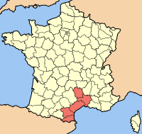
| Description | Map of the french Region Languedoc-Roussillon |
| Date | (UTC) |
| Source | |
| Author |
|
I, the copyright holder of this work, hereby publish it under the following license:

|
Permission is granted to copy, distribute and/or modify this document under the terms of the GNU Free Documentation License, Version 1.2 or any later version published by the Free Software Foundation; with no Invariant Sections, no Front-Cover Texts, and no Back-Cover Texts. A copy of the license is included in the section entitled GNU Free Documentation License. |
| This file is licensed under the Creative Commons Attribution-Share Alike 3.0 Unported license. | ||
| ||
| This licensing tag was added to this file as part of the GFDL licensing update. |
Original upload log
This image is a derivative work of the following images:
- File:Carte_Localisation_Regio_France_Languedoc-Roussillon.png licensed with GFDL
- 2006-01-14T19:07:57Z Maksim 200x189 (29282 Bytes) La bildo estas kopiita de wikipedia:nl. La originala priskribo estas: uit engelse wiki Credit(s): fr:Utilisateur:Rinaldum Source: stolen from french wikipedia (fr:File:Carte Localisation Région France Languedoc-Roussillon.
Uploaded with derivativeFX