Loading
  • 21 Aug, 2019

  • By, Wikipedia

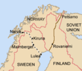
File:Lapland1940.png

This military map image could be re-created using vector graphics as an SVG file. This has several advantages; see Commons:Media for cleanup for more information. If an SVG form of this image is available, please upload it and afterwards replace this template with {{vector version available|new image name}}.


It is recommended to name the SVG file “Lapland1940.svg”—then the template Vector version available (or Vva) does not need the new image name parameter.

Original upload log

The original description page was here. All following user names refer to en.wikipedia.
  • 2004-11-12 15:10 Jniemenmaa 339×293× (11135 bytes) {{GFDL}}

Captions

Add a one-line explanation of what this file represents

Items portrayed in this file

depicts

12 November 2004

image/png

File history

Click on a date/time to view the file as it appeared at that time.

Date/TimeThumbnailDimensionsUserComment
current16:24, 5 February 2016Thumbnail for version as of 16:24, 5 February 2016339 × 293 (18 KB)HohumClearer for nations, route
20:49, 9 November 2009Thumbnail for version as of 20:49, 9 November 2009339 × 293 (8 KB)NuclearWarfareReverted to version as of 05:50, 13 February 2007
20:49, 9 November 2009Thumbnail for version as of 20:49, 9 November 2009339 × 293 (11 KB)File Upload Bot (Magnus Manske) {{BotMoveToCommons|en.wikipedia|year={{subst:CURRENTYEAR}}|month={{subst:CURRENTMONTHNAME}}|day={{subst:CURRENTDAY}}}} {{Information |Description={{en|Based on Brion Vibber's map of Europe. [http://leuksman.com/misc/maps.php which can be found here]}} |
05:50, 13 February 2007Thumbnail for version as of 05:50, 13 February 2007339 × 293 (8 KB)Tene~commonswikiOptimised (0;320;r)
06:25, 17 August 2005Thumbnail for version as of 06:25, 17 August 2005339 × 293 (11 KB)Stephan HerzBased on Brion Vibber's map of Europe. [http://leuksman.com/misc/maps.php which can be found here] {{GFDL}}

Global file usage

The following other wikis use this file:

Metadata