Click on a date/time to view the file as it appeared at that time.
| Date/Time | Thumbnail | Dimensions | User | Comment |
|---|
| current | 12:27, 16 July 2012 | 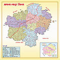 | 1,524 × 1,524 (1.36 MB) | Woodoome | {{subst:Upload marker added by en.wp UW}} {{Information |Description = {{en|Latur District political map}} |Source = http://zplatur.gov.in/htmldocs/leftframe/LaturMap.html |Author = zplatur |Permission = http://zplatur.gov.in/htmldocs/leftframe/LaturMa... |
The following page uses this file:
The following other wikis use this file:
- Usage on kn.wikipedia.org
- Usage on mr.wikipedia.org
- Usage on te.wikipedia.org
