21 Aug, 2019
By, Wikipedia
File:Lexington-Fayette Metro.png
https://creativecommons.org/publicdomain/mark/1.0/PDMCreative Commons Public Domain Mark 1.0falsefalse
Captions
Add a one-line explanation of what this file represents
Click on a date/time to view the file as it appeared at that time.
| Date/Time | Thumbnail | Dimensions | User | Comment | |
|---|---|---|---|---|---|
| current | 20:46, 19 September 2010 | 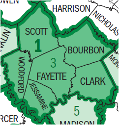 | 242 × 255 (27 KB) | J654567 | {{Information |Description= U.S. Census Bureau map of the Lexington-Fayette Metropolitan Statistical Area. |Source= [http://ftp2.census.gov/geo/maps/metroarea/stcbsa_pg/Nov2004/cbsa2004_KY.pdf U.S. Census Bureau Map Products] |Date= September 19, 2010 |Au |