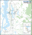
File:Link Light Rail Geographic Map.svg
Click on a date/time to view the file as it appeared at that time.
| Date/Time | Thumbnail | Dimensions | User | Comment | |
|---|---|---|---|---|---|
| current | 11:24, 31 August 2024 |  | 1,600 × 1,744 (687 KB) | Twotwofourtysix | Update Lynwood Link Extension |
| 02:49, 5 May 2024 |  | 1,600 × 1,744 (597 KB) | Twotwofourtysix | Update with opening of line section | |
| 07:58, 4 May 2024 |  | 1,600 × 1,744 (635 KB) | OrdinaryScarlett | Update date | |
| 07:01, 4 May 2024 |  | 1,600 × 1,744 (673 KB) | SounderBruce | Remove CDP "boundaries" that change with every census; cleanup label placement on 2 Line | |
| 02:41, 1 May 2024 |  | 1,600 × 1,744 (651 KB) | OrdinaryScarlett | Update 2 Line and Lynnwood and Federal Way Link Extension station names | |
| 20:05, 19 January 2024 |  | 1,600 × 1,744 (690 KB) | SounderBruce | Removing most labels for CDPs, which are arbitrarily assigned by the Census Bureau and change frequently; boundaries should also be deleted at some point | |
| 14:18, 19 January 2024 |  | 1,600 × 1,744 (650 KB) | Twotwofourtysix | Adds legend & title, adjusts colours | |
| 15:58, 18 January 2024 |  | 1,600 × 1,744 (1.76 MB) | Twotwofourtysix | Uploaded own work with UploadWizard |
File usage
The following pages on the English Wikipedia use this file (pages on other projects are not listed):
Global file usage
The following other wikis use this file:
- Usage on ca.wikipedia.org
- Usage on cs.wikipedia.org
- Usage on de.wikipedia.org
- Usage on de.wikivoyage.org
- Usage on es.wikipedia.org
- Usage on fa.wikipedia.org
- Usage on fr.wikipedia.org
- Usage on it.wikipedia.org
- Usage on mr.wikipedia.org
- Usage on uk.wikipedia.org
- Usage on www.wikidata.org
- Usage on zh.wikipedia.org