File:Location Map Central San Diego.png
Click on a date/time to view the file as it appeared at that time.
| Date/Time | Thumbnail | Dimensions | User | Comment | |
|---|---|---|---|---|---|
| current | 01:48, 26 September 2010 | 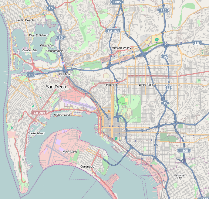 | 689 × 655 (527 KB) | Zzyzx11 | {{OpenStreetMap |location=Central San Diego |top=32.8134 |bottom=32.6609 |left=-117.2629 |right=-117.072 }} Category:OpenStreetMap maps of the United States |
File usage
The following 88 pages use this file:
- 2017 Red Bull Air Race of San Diego
- Alcazar Garden
- Amici Park
- Balboa Park (San Diego)
- Balboa Park Gardens
- Balboa Theatre
- Barrio Logan, San Diego
- Birdland, San Diego
- Cabrillo National Monument
- California Quadrangle
- Casa de Estudillo
- City Heights, San Diego
- Columbia, San Diego
- Crazee Burger
- Eagles Hall (San Diego)
- East Village, San Diego
- El Cortez (San Diego)
- El Prado Complex
- Embarcadero Marina Park North
- Embarcadero Marina Park South
- Fleet Science Center
- Ford Building (San Diego)
- Gaslamp Quarter, San Diego
- George W. Marston House
- Giant Dipper (Belmont Park)
- Granger Hall (National City, California)
- Harper's Topiary Garden
- Heilman Villas
- Hillcrest, San Diego
- Horton Grand Hotel
- Horton Plaza Park
- House of Charm
- Independent Order of Odd Fellows Building (San Diego)
- Jacob Weinberger United States Courthouse
- Kate Sessions Memorial Park
- Kensington, San Diego
- Kosa'aay
- Linda Vista, San Diego
- Little Italy, San Diego
- Lucha Libre Taco Shop
- MCRD San Diego Command Museum
- Manchester Grand Hyatt San Diego
- Marina, San Diego
- Maritime Museum of San Diego
- Medico-Dental Building
- Mingei International Museum
- Mission Beach, San Diego
- Mission Brewery Plaza
- Mission San Diego de Alcalá
- Mission Valley, San Diego
- Museum of Photographic Arts
- Museum of Us
- Naval Training Center San Diego
- Normal Heights, San Diego
- Ocean Beach, San Diego
- Old Town San Diego State Historic Park
- Pacific Beach, San Diego
- Pantoja Park
- Park Place Methodist Episcopal Church South
- Petco Park
- Peterson Gymnasium
- Presidio Park
- Presidio of San Diego
- Pythias Lodge Building (San Diego)
- Rosecroft (San Diego)
- Ruocco Park
- San Diego Air & Space Museum
- San Diego Automotive Museum
- San Diego Hall of Champions
- San Diego History Center
- San Diego Model Railroad Museum
- San Diego Natural History Museum
- San Diego Trust and Savings Bank Building
- St. Matthew's Episcopal Church (National City, California)
- Swan Canyon, San Diego
- The Rady Shell at Jacobs Park
- The San Diego Museum of Art
- Timken Museum of Art
- U.S. Grant Hotel
- UC San Diego Medical Center, Hillcrest
- USS Midway Museum
- University Heights, San Diego
- Whaley House (San Diego, California)
- User:DarkNight0917/Creations
- Wikipedia:Graphics Lab/Map workshop/Archive/Oct 2011
- File talk:Location map Central San Diego.png
- Module:Location map/data/United States San Diego
- Module:Location map/data/United States San Diego/doc
Global file usage
The following other wikis use this file:
- Usage on ar.wikipedia.org
- Usage on azb.wikipedia.org
- Usage on bg.wikipedia.org
- Usage on ceb.wikipedia.org
- Usage on fa.wikipedia.org
- Usage on fr.wikipedia.org
- Cabrillo National Monument
- San Diego-Coronado Bridge
- San Diego Stadium
- Petco Park
- Aéroport international de San Diego
- Pechanga Arena
- SeaWorld San Diego
- Musée maritime de San Diego
- Naval Amphibious Base Coronado
- Manchester Grand Hyatt Hotel
- Symphony Towers
- Marriott Marquis San Diego Marina
- One America Plaza
- Parc Balboa
- Pinnacle Marina Tower
- Harbor Club Condominiums
- Vantage Pointe Condominium
- Bayside at the Embarcadero
- Omni San Diego Hotel
- Emerald Plaza
- Gaslamp Quarter
- Base navale de San Diego
- Pacific Beach (San Diego)
- Mission Bay (San Diego)
- Hotel del Coronado
- Point Loma
- Hillcrest (San Diego)
- Mission Valley
- Parc historique d'État d'Old Town San Diego
- Mission Beach
- Little Italy (San Diego)
- Downtown San Diego
- Casa de Estudillo
- Old Town (San Diego)
- Musée d'Art de San Diego
- Pont Cabrillo
- North Park (San Diego)
- Normal Heights
View more global usage of this file.