File:Location Map United States Cleveland.png
Click on a date/time to view the file as it appeared at that time.
| Date/Time | Thumbnail | Dimensions | User | Comment | |
|---|---|---|---|---|---|
| current | 00:10, 6 March 2011 | 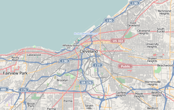 | 610 × 388 (300 KB) | Hillrhpc | {{OpenStreetMap |location= Cleveland, Ohio |authors=User:Hillrhpc |top= 41.573 |bottom= 41.390 |left= -81.873 |right= -81.489 }} Category:OpenStreetMap maps of the United States Category:Cleveland, Ohio |
File usage
More than 100 pages use this file. The following list shows the first 100 pages that use this file only. A full list is available.
- Adelbert Hall
- Allen Memorial Medical Library
- Alta Public Library
- Andrew and James Dall Houses
- Ansel Road Apartment Buildings Historic District
- Archwood Avenue Historic District
- Archwood Congregational Church
- Baker Motor Vehicle Company Building
- Bingham Company Warehouse
- Body Block
- Bohemian National Hall (Cleveland, Ohio)
- Bomante House
- Broadway Avenue Historic District (Cleveland, Ohio)
- Broadway–Slavic Village
- Brooklyn Bank Building
- Brownell School and Annex
- Bryant Building (Cleveland)
- Buckeye–Shaker
- Cedar Glen Apartments
- Central YMCA (Cleveland, Ohio)
- Children's Museum of Cleveland
- Church of the Covenant (Cleveland)
- Cleveland Arcade
- Cleveland City Hall
- Cleveland Home for Aged Colored People
- Cleveland Masonic Temple
- Cleveland Stadium
- Cozad–Bates House
- Crawford-Tilden Apartments
- Cuyahoga County Courthouse
- Detroit–Superior Bridge
- Dittrick Museum of Medical History
- Dr. James Bell House
- Dr. William Gifford House
- Dunham Tavern
- Euclid Avenue Historic District (Cleveland, Ohio)
- Fenn Tower
- First Church of Christ, Scientist (Cleveland, Ohio)
- First Methodist Church (Cleveland, Ohio)
- Flora Stone Mather College Historic District
- Franklin Castle
- Grays Armory
- Great Lakes Science Center
- Guardian Bank Building
- H. Black and Company Building
- Holy Rosary Church (Cleveland, Ohio)
- Hope Memorial Bridge
- Howard M. Metzenbaum United States Courthouse
- Huntington Bank Field
- Irishtown Bend
- James A. Garfield Memorial
- Killing of Tamir Rice
- League Park
- Maltz Performing Arts Center
- North Presbyterian Church (Cleveland, Ohio)
- Oheb Zedek Cedar Sinai Synagogue
- Ohio City, Cleveland
- Park Building (Cleveland, Ohio)
- Parkview Apartments (Cleveland)
- Perry–Payne Building
- Phillip Gaensslen House
- Pilgrim Congregational Church (Cleveland, Ohio)
- Playhouse Square
- Plaza Apartments (Cleveland, Ohio)
- Progressive Field
- Public Square, Cleveland
- Riverside Cemetery Chapel
- Riverside Cemetery Gatehouse
- Rocket Engine Test Facility
- Rocket Mortgage FieldHouse
- Sacred Heart of Jesus Church (Cleveland, Ohio)
- Saint Ignatius High School (Cleveland)
- Sarah Benedict House
- Shaker Village Historic District (Shaker Heights, Ohio)
- Shiloh Baptist Church (Cleveland, Ohio)
- Society for Savings Building
- Southworth House (Cleveland, Ohio)
- St. Elizabeth of Hungary Shrine (Cleveland, Ohio)
- St. John's Episcopal Church (Cleveland, Ohio)
- St. John African Methodist Episcopal Church (Cleveland, Ohio)
- St. Joseph's Church and Friary
- St. Luke's Hospital (Cleveland, Ohio)
- St. Michael the Archangel Church (Cleveland, Ohio)
- St. Paul's Episcopal Church (Cleveland, Ohio)
- St. Stephen's Catholic Church (Cleveland, Ohio)
- Superior Building
- Tavern Club (Cleveland, Ohio)
- Temple Tifereth-Israel
- Third Church of Christ, Scientist (Cleveland, Ohio)
- Tremont, Cleveland
- Trinity Cathedral (Cleveland, Ohio)
- USS Cod
- Wade Memorial Chapel
- Wade Park District
- Warehouse District, Cleveland
- Weizer Building (11801 Buckeye Road, Cleveland, Ohio)
- Weizer Building (8935 Buckeye Road, Cleveland, Ohio)
- West Side Market
- Zero Gravity Research Facility
- Zion Lutheran Church (Cleveland, Ohio)
View more links to this file.
Global file usage
The following other wikis use this file:
- Usage on ar.wikipedia.org
- Usage on azb.wikipedia.org
- Usage on ceb.wikipedia.org
- Usage on fa.wikipedia.org
- Usage on fr.wikipedia.org
- Cleveland Museum of Art
- Rock and Roll Hall of Fame
- Progressive Field
- Rocket Mortgage FieldHouse
- Aéroport international de Cleveland-Hopkins
- Wolstein Center
- Luna Park (Cleveland)
- Brotherhood Park
- Modèle:Géolocalisation/Cleveland
- Module:Carte/données/cleveland
- Middlefield Cheese Stadium
- USS Cod (SS-224)
- Airport (métro de Cleveland)
- Usage on ja.wikipedia.org
- Usage on kn.wikipedia.org
- Usage on pl.wikipedia.org
- Rock and Roll Hall of Fame
- Case Western Reserve University
- Key Tower
- Port lotniczy Cleveland-Hopkins
- Terminal Tower
- BP Tower
- Erieview Tower
- One Cleveland Center
- Sobór św. Teodozjusza w Cleveland
- Rocket Mortgage FieldHouse
- Parafia św. Barbary w Cleveland
- Parafia św. Kazimierza w Cleveland
- Parafia św. Jana Kantego w Cleveland
- Cleveland Museum of Art
- FirstEnergy Stadium
- Progressive Field
- Moduł:Mapa/dane/Cleveland
- Evergreen Cooperatives
- Usage on pl.wikibooks.org
- Usage on si.wikipedia.org
- Usage on tr.wikipedia.org
- Usage on vep.wikipedia.org
View more global usage of this file.