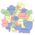
File:Location Of Hradec Kralove.PNG
Click on a date/time to view the file as it appeared at that time.
| Date/Time | Thumbnail | Dimensions | User | Comment | |
|---|---|---|---|---|---|
| current | 14:11, 10 February 2017 |  | 652 × 646 (48 KB) | Valdemar | Upřesnění na hranice komisí místní samosprávy podle diskuse zde |
| 15:50, 7 March 2016 |  | 652 × 646 (16 KB) | Avayak | bezeztrátově optimalizováno | |
| 19:34, 24 December 2015 |  | 652 × 646 (46 KB) | Valdemar | correction of borders Věkoše-Pouchov | |
| 08:45, 31 May 2007 |  | 652 × 646 (45 KB) | Riza-do~commonswiki | {{Information |Description= |Source= |Date= |Author=Riza-do |Permission= |other_versions= }} |
File usage
The following page uses this file:
Global file usage
The following other wikis use this file:
- Usage on ar.wikipedia.org
- Usage on arz.wikipedia.org
- Usage on ca.wikipedia.org
- Usage on cs.wikipedia.org
- Usage on de.wikipedia.org
- Usage on el.wikipedia.org
- Usage on eo.wikipedia.org
- Usage on es.wikipedia.org
- Usage on eu.wikipedia.org
- Usage on hu.wikipedia.org
- Usage on la.wikipedia.org
- Usage on lmo.wikipedia.org
- Usage on pl.wikipedia.org
- Usage on ro.wikipedia.org
- Usage on th.wikipedia.org
- Usage on tt.wikipedia.org
- Usage on ur.wikipedia.org
- Usage on www.wikidata.org