Loading
  • 21 Aug, 2019

  • By, Wikipedia

File:London Stone, Yantlet 338.jpg

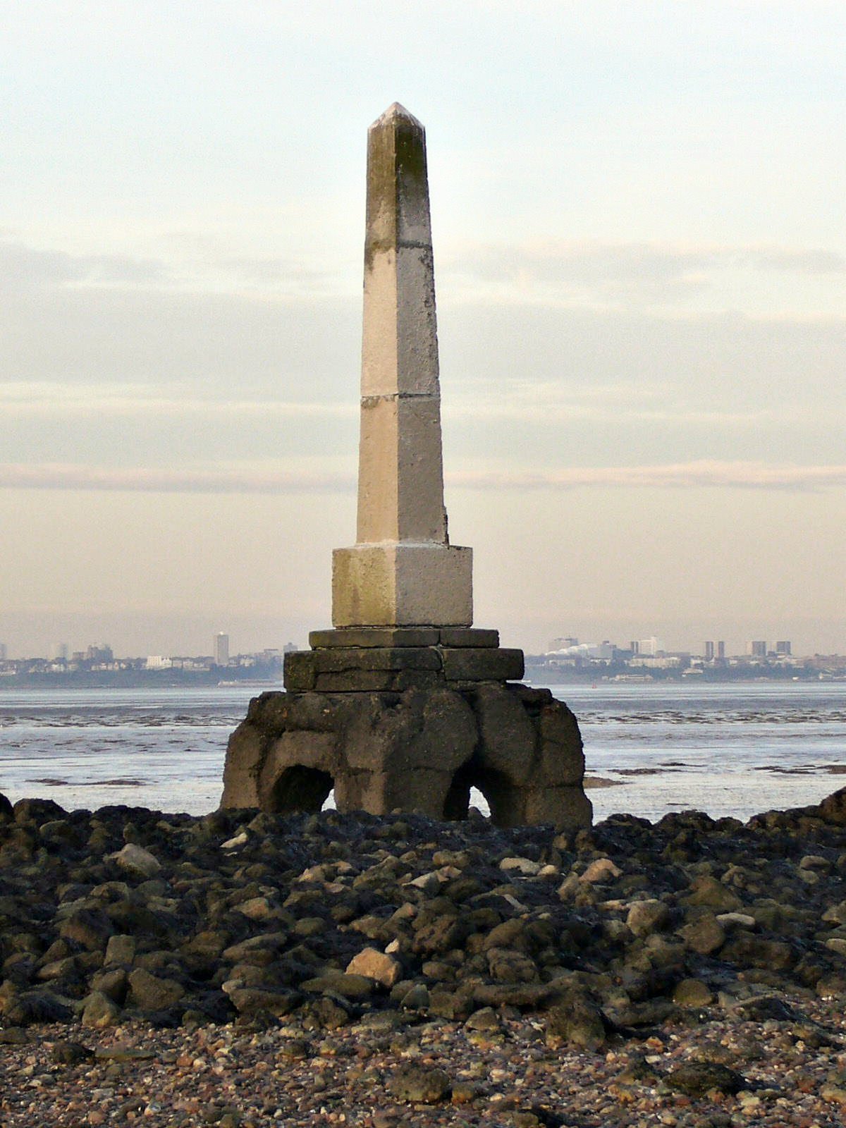
The corresponding marker above London is London Stone, Staines at 31 km as the crow flies upstream from London Bridge. But this stone at Yantlet is 54 km downstream.

Direct access to the stone is difficult because Grain Marsh is an MoD firing range. To take this photo, I approached from the British Pilot in Allhallows and paddled through Yantlet Creek. Here are my feet on the way back. More images.
Date Source Own work Author Roger W Haworth Other versions
Camera location51° 28′ 33.38″ N, 0° 40′ 40.19″ E  Heading=22° Kartographer map based on OpenStreetMap.View this and other nearby images on: OpenStreetMapinfo
Roger W Haworth, the copyright holder of this work, hereby publishes it under the following licenses:
GNU head Permission is granted to copy, distribute and/or modify this document under the terms of the GNU Free Documentation License, Version 1.2 or any later version published by the Free Software Foundation; with no Invariant Sections, no Front-Cover Texts, and no Back-Cover Texts. A copy of the license is included in the section entitled GNU Free Documentation License.
w:en:Creative Commons
attribution share alike
This file is licensed under the Creative Commons Attribution-Share Alike 3.0 Unported license.
Attribution: Roger W Haworth
You are free:
  • to share – to copy, distribute and transmit the work
  • to remix – to adapt the work
Under the following conditions:
  • attribution – You must give appropriate credit, provide a link to the license, and indicate if changes were made. You may do so in any reasonable manner, but not in any way that suggests the licensor endorses you or your use.
  • share alike – If you remix, transform, or build upon the material, you must distribute your contributions under the same or compatible license as the original.
This licensing tag was added to this file as part of the GFDL licensing update.
w:en:Creative Commons
attribution
This file is licensed under the Creative Commons Attribution 2.5 Generic license.
Attribution: Roger W Haworth
You are free:
  • to share – to copy, distribute and transmit the work
  • to remix – to adapt the work
Under the following conditions:
  • attribution – You must give appropriate credit, provide a link to the license, and indicate if changes were made. You may do so in any reasonable manner, but not in any way that suggests the licensor endorses you or your use.
You may select the license of your choice.

Captions

Add a one-line explanation of what this file represents

Items portrayed in this file

depicts

51°28'33.38"N, 0°40'40.19"E

heading: 22 degree

31 January 2007

File history

Click on a date/time to view the file as it appeared at that time.

Date/TimeThumbnailDimensionsUserComment
current18:44, 12 May 2011Thumbnail for version as of 18:44, 12 May 20111,200 × 1,600 (257 KB)HohumLevels
05:12, 13 May 2010Thumbnail for version as of 05:12, 13 May 20101,200 × 1,600 (211 KB)RHaworth{{Information |Description=London Stone Yantlet |Source={{own}} |Date= |Author=RHaworth |Permission= |other_versions= }} {{subst:user:RHaworth/mylic}}

The following 4 pages use this file:

Global file usage

The following other wikis use this file:

Metadata