Click on a date/time to view the file as it appeared at that time.
| Date/Time | Thumbnail | Dimensions | User | Comment |
|---|
| current | 04:01, 25 April 2007 |  | 331 × 303 (12 KB) | Ruhrfisch | == Summary == {{Information| |Description= Locator Map of Louisiana, United States |Source= taken from US Census website [http://factfinder.census.gov/] and modified by User:Ruhrfisch |Date= April 2007 |Author= US Census, Ruhrfisch |Permission= US Ce |
| 03:32, 2 April 2007 | 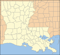 | 331 × 303 (12 KB) | Ruhrfisch | {{Information| |Description= Locator Map of Louisiana, United States |Source= taken from US Census website [http://factfinder.census.gov/] and modified by User:Ruhrfisch |Date= April 2007 |Author= US Census, Ruhrfisch |Permission= US Census / US Gove |
| 18:44, 1 April 2007 |  | 320 × 303 (11 KB) | Ruhrfisch | {{Information| |Description= Locator Map of Louisiana, United States |Source= taken from US Census website [http://factfinder.census.gov/] and modified by User:Ruhrfisch |Date= April 2007 |Author= US Census, Ruhrfisch |Permission= US Census / US Gove |


