File:Major Watersheds In Lycoming County Pennsylvania.png

Click on a date/time to view the file as it appeared at that time.
| Date/Time | Thumbnail | Dimensions | User | Comment | |
|---|---|---|---|---|---|
| current | 22:37, 22 March 2009 | 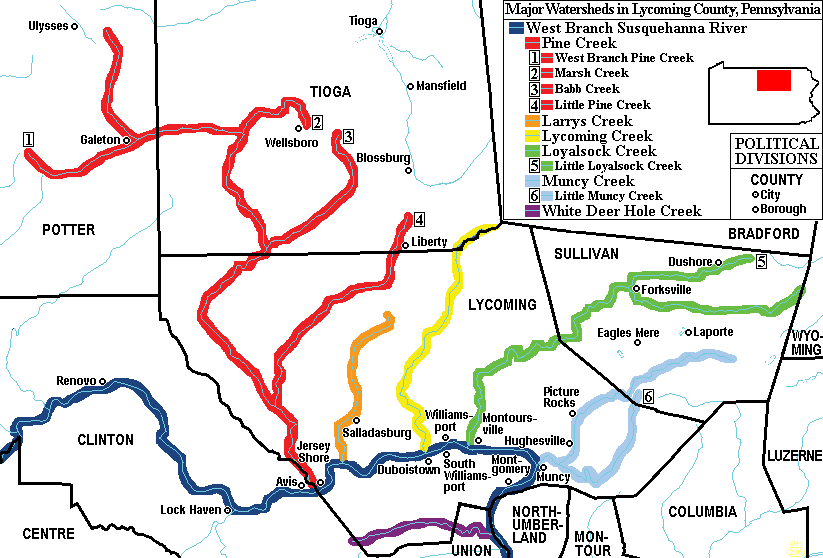 | 823 × 558 (31 KB) | Mahahahaneapneap | Compressed |
| 16:13, 28 August 2006 |  | 823 × 558 (61 KB) | Ruhrfisch | {{Information |Description= Map of Major Watersheds in Lycoming County, Pennsylvania, USA. |Source= Information on river and stream positions and county boundaries is taken from US Census website[http://factfinder.census.gov/], modified by [[User:Ruhrfis | |
| 18:39, 24 August 2006 |  | 823 × 558 (62 KB) | Kmusser | ||
| 04:20, 14 March 2006 |  | 823 × 558 (30 KB) | Ruhrfisch | Map of Major Watersheds in Lycoming County Pennsylvania. Information on river and stream positions and county boundaries is taken from US Census website[http://factfinder.census.gov/] and modified by User:Ruhrfisch in March 2006 (with simplified color | |
| 17:09, 6 March 2006 |  | 823 × 558 (45 KB) | Ruhrfisch | Map of Major Watersheds in Lycoming County Pennsylvania. Information on river and stream positions and county boundaries is taken from US Census website[http://factfinder.census.gov/] and modified by User:Ruhrfisch in March 2006 (marsh Creek added). M |
The following other wikis use this file: