File:Maluku Locator Topography.png
Click on a date/time to view the file as it appeared at that time.
| Date/Time | Thumbnail | Dimensions | User | Comment | |
|---|---|---|---|---|---|
| current | 07:47, 3 September 2007 | 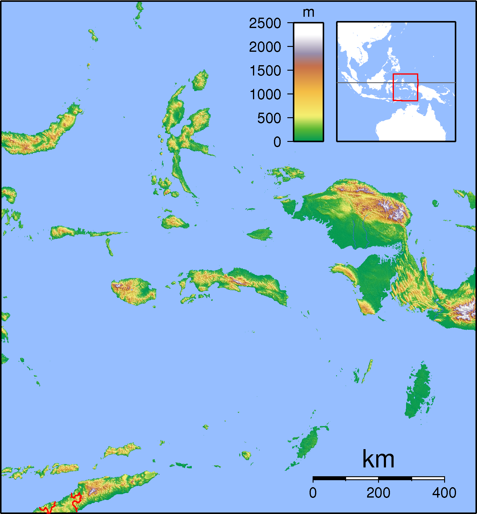 | 1,567 × 1,688 (765 KB) | Sadalmelik | {{Information |Description=Topographic locator map for Maluku Islands, Indonesia. Created with GMT from public domain SRTM data. Left: 123, bottom: -9.5, right:136 top:4.5 |Source=self-made |Date=Sep 3, 2007 |Author= Sadalmelik }} [[C |
File usage
The following pages on the English Wikipedia use this file (pages on other projects are not listed):
Global file usage
The following other wikis use this file:
- Usage on ar.wikipedia.org
- Usage on ban.wikipedia.org
- Usage on ba.wikipedia.org
- Usage on bn.wikipedia.org
- Usage on ceb.wikipedia.org
- Usage on eo.wikipedia.org
- Usage on es.wikipedia.org
- Usage on fa.wikipedia.org
- Usage on fr.wikipedia.org
- Usage on gl.wikipedia.org
- Usage on id.wikipedia.org
- Usage on ilo.wikipedia.org
- Usage on it.wikipedia.org
- Usage on it.wikivoyage.org
- Usage on ja.wikipedia.org
- Usage on ka.wikipedia.org
- Usage on kn.wikipedia.org
- Usage on mk.wikipedia.org
- Usage on ml.wikipedia.org
- Usage on mzn.wikipedia.org
- Usage on nl.wikipedia.org
View more global usage of this file.