Loading
  • 21 Aug, 2019

  • By, Wikipedia

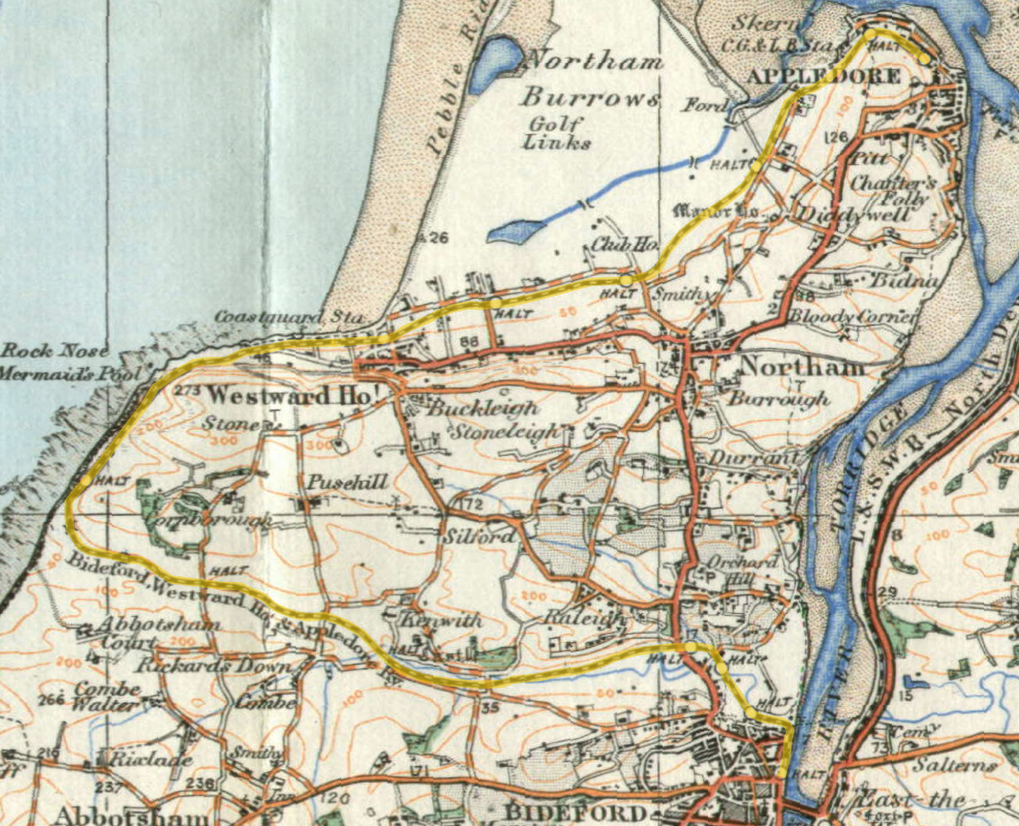
File:Map BWHA Railway.jpg

This is because it is one of the following:

  1. It is a photograph taken prior to 1 June 1957; or
  2. It was published prior to 1974; or
  3. It is an artistic work other than a photograph or engraving (e.g. a painting) which was created prior to 1974.

HMSO has declared that the expiry of Crown Copyrights applies worldwide (ref: HMSO Email Reply)
More information.

See also Copyright and Crown copyright artistic works.

Deutsch  English  Español  français  italiano  Nederlands  polski  português  sicilianu  slovenščina  suomi  Türkçe  македонски  русский  українська  മലയാളം  한국어  日本語  简体中文  繁體中文  العربية  +/−

Captions

Add a one-line explanation of what this file represents

Items portrayed in this file

depicts

File history

Click on a date/time to view the file as it appeared at that time.

Date/TimeThumbnailDimensionsUserComment
current16:29, 3 August 2010Thumbnail for version as of 16:29, 3 August 20102,054 × 1,664 (915 KB)Old MoonrakerSuggestions from en:User:Redrose64: grid lines at two-mile intervals and not as shown previously, remove scale accordingly
15:36, 2 August 2010Thumbnail for version as of 15:36, 2 August 2010938 × 794 (335 KB)Old MoonrakerAdded a scale: gridlines were en:Minute of arc on this edition
13:30, 2 August 2010Thumbnail for version as of 13:30, 2 August 2010938 × 794 (218 KB)Old Moonraker{{Information |Description=Detail from en:Ordnance Survey "New Popular Edition" Sheet 118. Grid lines at 1000 metres. Colour highlighting by uploader. |Source=Scanned by Arthur Rowbottom at http://www.ponies.me.uk/maps/about.html |Date=1919 |Author=[

Global file usage

The following other wikis use this file:

Metadata