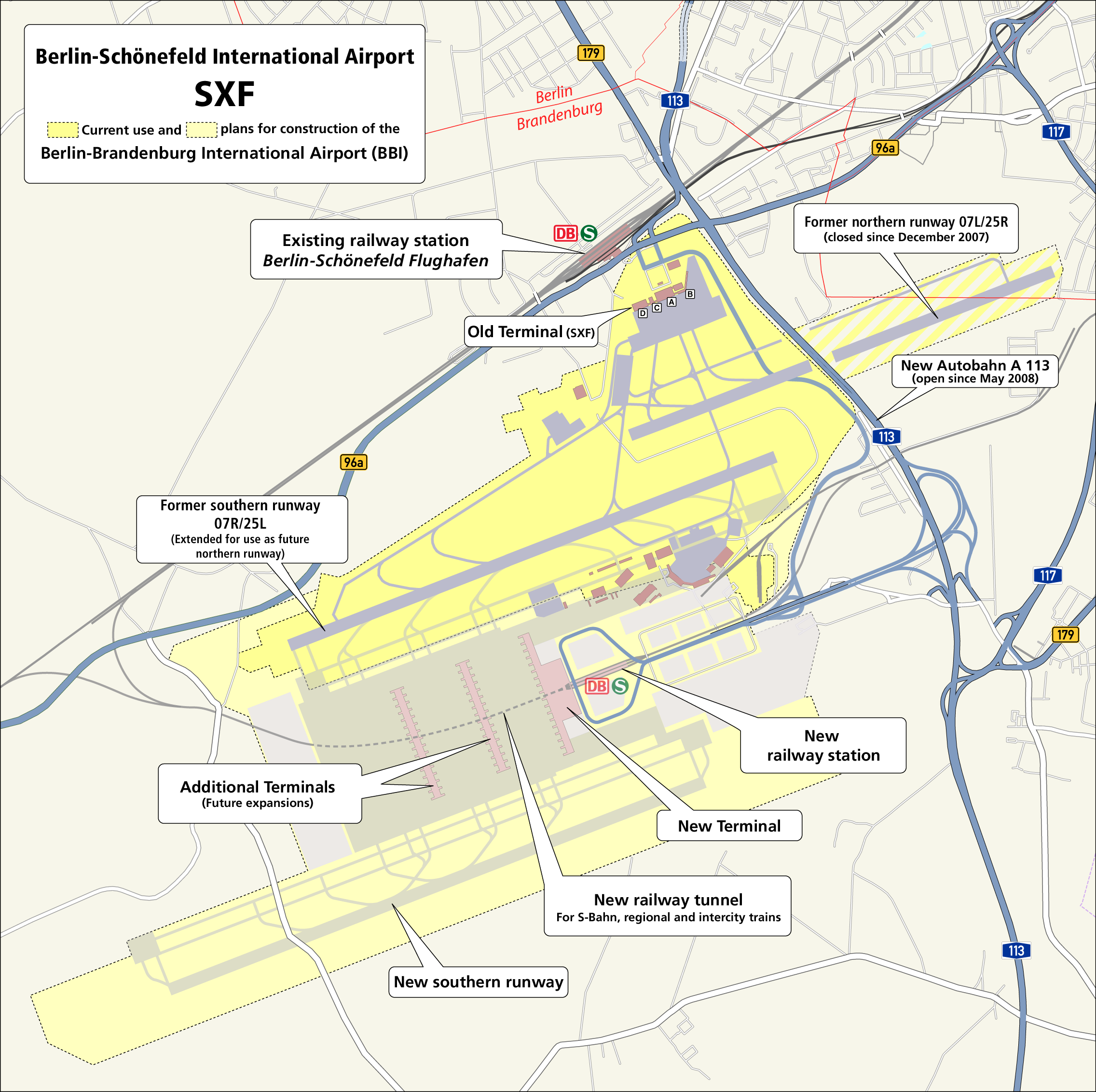
File:Map Berlin-Schoenefeld Airport SFX With Planed BBI.png
Translation of Image:Karte- Flughafen Berlin-Schönefeld SXF.png created by Maximilian Dörrbecker (Chumwa), based on:
Author
Maximilian Dörrbecker (map), Michael F. Mehnert (english text)
Other versions
- some PDF exports from OpenStreetMap
- this map from Berliner76
- a presentation about the "Planfeststellung zum Ausbau des Flughafens Berlin-Schönefeld"
- an information map from the Berliner Flughäfen
- some logos and signs: S-Bahn, DB, BAB113, BAB117, B96a, B179
-
 German version
 -
 English version
 -
 Hebrew version
 -


|
This architecture image could be re-created using vector graphics as an SVG file. This has several advantages; see Commons:Media for cleanup for more information. If an SVG form of this image is available, please upload it and afterwards replace this template with
{{vector version available|new image name}}.
It is recommended to name the SVG file “Map Berlin-Schoenefeld Airport SFX with planed BBI.svg”—then the template Vector version available (or Vva) does not need the new image name parameter. |
Licensing
This file is licensed under the Creative Commons Attribution-Share Alike 2.5 Generic license.
- You are free:
- to share – to copy, distribute and transmit the work
- to remix – to adapt the work
- Under the following conditions:
- attribution – You must give appropriate credit, provide a link to the license, and indicate if changes were made. You may do so in any reasonable manner, but not in any way that suggests the licensor endorses you or your use.
- share alike – If you remix, transform, or build upon the material, you must distribute your contributions under the same or compatible license as the original.