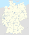
File:Map D A281.svg

|
This map has been made or improved in the German Kartenwerkstatt (Map Lab). You can propose maps to improve as well.
|

|
This map has been made or improved in the German Kartenwerkstatt (Map Lab). You can propose maps to improve as well.
|
Click on a date/time to view the file as it appeared at that time.
| Date/Time | Thumbnail | Dimensions | User | Comment | |
|---|---|---|---|---|---|
| current | 18:10, 27 September 2019 |  | 1,073 × 1,272 (465 KB) | NordNordWest | upd |
| 17:30, 23 December 2018 |  | 1,073 × 1,272 (467 KB) | NordNordWest | upd | |
| 15:16, 23 January 2018 |  | 1,073 × 1,272 (464 KB) | NJ Giggie | upd | |
| 16:02, 18 October 2012 |  | 1,073 × 1,272 (458 KB) | NordNordWest | == {{int:filedesc}} == {{Information |Description= {{de|Karte der Bundesautobahn 281 in Deutschland}} {{en|Map of Bundesautobahn 281 in Germany}} |Source={{Own}} |Date={{Date|2012|10|18}} |Author={{U|NordNordWest}} |Permission= |other_versions= }} ==... |
The following other wikis use this file: