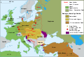
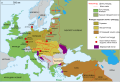
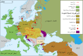
File:Map Europe 1923-fr.svg
[]
-
 bosanski • Bosnian
 -
 català • Catalan
 -
 čeština • Czech
 -
 Deutsch • German
 -
 English • English
 -
 español • Spanish
 -
 français • French
 -
 hrvatski • Croatian
 -
 italiano • Italian
 -
 magyar • Hungarian
 -
 Nederlands • Dutch
 -
 português do Brasil • Brazilian Portuguese
 -
 vèneto • Venetian
 -
 Ελληνικά • Greek
 -
 буряад • Russia Buriat
 -
 македонски • Macedonian
 -
 русский • Russian
 -
 বাংলা • Bangla
 -
 العربية • Arabic


|
This SVG file contains embedded text that can be translated into your language, using any capable SVG editor, text editor or the SVG Translate tool. For more information see: About translating SVG files. |


