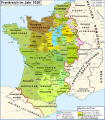
File:Map France 1030-fr.svg
Data from the same and:
- Olivier Guyotjeannin, Atlas de l'histoire de France IXe-XVe siècle, Paris, 2005
- François Menant, H. Martin, B. Merdignac & M. Chauvin, Les Capétiens - Histoire et dictionnaire 987-1328, Robert Laffont, Paris, 1999
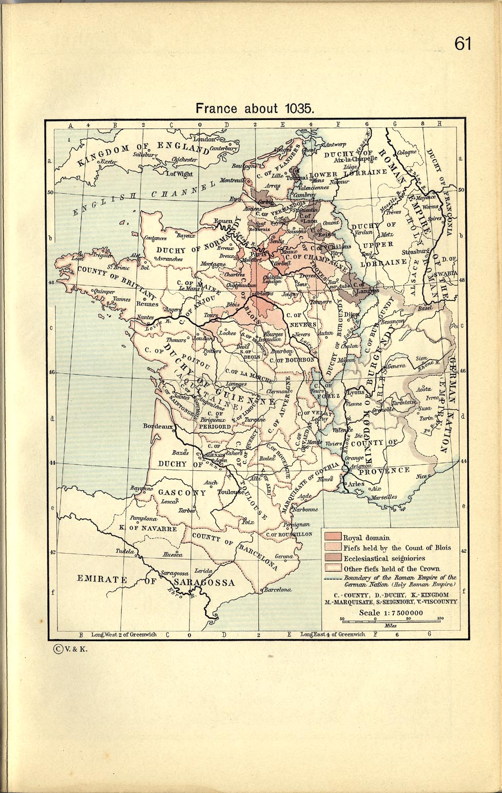
Français : Création personnelle, d'après France about 1035, in William R. Shepherd, The Historical Atlas, 1911
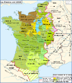
Données d'après cette source et :
- Olivier Guyotjeannin, Atlas de l'histoire de France IXe-XVe siècle, Paris, 2005
- François Menant, H. Martin, B. Merdignac & M. Chauvin, Les Capétiens - Histoire et dictionnaire 987-1328, Robert Laffont, Paris, 1999
[]
-
 brezhoneg
 -
 català
 -
 Deutsch
 -
 español
 -
 français
 -
 русский


-
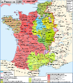 1180
1180 -
 1477
1477


