File:Map Hermannstrasse 1842 G.JPG
Part of: Image:ZLB-Berliner_Ansichten-Maerz.jpg
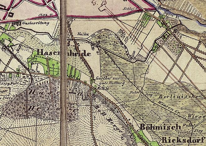
Map for the maneuver of the "Garde-Corps" in autumn 1842.
Scale approximately 1:50.000
Scanned by the Zentral- und Landesbibliothek Berlin (ZLB), use under Public Domain allowed
- Description: Part from the old border of Berlin (red line) to Berlin-Neukölln, called in this time "Rixdorf" or "Böhmisch-Rixdorf"
Licensing
|
This work is in the public domain in its country of origin and other countries and areas where the copyright term is the author's life plus 70 years or fewer. | |
| This file has been identified as being free of known restrictions under copyright law, including all related and neighboring rights. | |