Click on a date/time to view the file as it appeared at that time.
| Date/Time | Thumbnail | Dimensions | User | Comment |
|---|
| current | 12:57, 19 June 2018 | 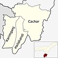 | 609 × 609 (94 KB) | SlowPhoton | Clear version of the map |
| 23:28, 28 June 2012 | 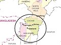 | 538 × 401 (48 KB) | Tkdebnath | {{subst:Upload marker added by en.wp UW}} {{Information |Description = {{en|This is the map of Barak Valley}} |Source = http://www.mapsofindia.com/maps/assam/ |Author = mapsofindia.com |Permission = http://www.mapsofindia.com/copyright/ }} {{PD-autho... |
The following pages on the English Wikipedia use this file (pages on other projects are not listed):
The following other wikis use this file:
- Usage on as.wikipedia.org
- Usage on bn.wikipedia.org
- Usage on es.wikipedia.org
- Usage on hi.wikipedia.org
- Usage on incubator.wikimedia.org
- Usage on ml.wikipedia.org
- Usage on sat.wikipedia.org
- Usage on simple.wikipedia.org
- Usage on ta.wikipedia.org
- Usage on www.wikidata.org
This file contains additional information, probably added from the digital camera or scanner used to create or digitize it.
If the file has been modified from its original state, some details may not fully reflect the modified file.

