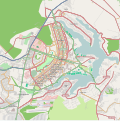
File:Map Of Brasília And Surrounding Areas.svg
Click on a date/time to view the file as it appeared at that time.
| Date/Time | Thumbnail | Dimensions | User | Comment | |
|---|---|---|---|---|---|
| current | 03:16, 12 August 2012 |  | 1,030 × 1,031 (6.48 MB) | Felipe Menegaz | =={{int:filedesc}}== {{Information |description= {{en|1=Map of Brasília, Brazil.}} {{pt|1=Mapa de Brasília, Brasil.}} |date=2012-08-12 |source=http://www.openstreetmap.org/ |author=OpenStreetMap |per... |
File usage
The following 8 pages use this file:
Global file usage
The following other wikis use this file:
- Usage on af.wikipedia.org
- Usage on ar.wikipedia.org
- Usage on ceb.wikipedia.org
- Usage on fa.wikipedia.org
- Usage on he.wikipedia.org
- Usage on hr.wikipedia.org
- Usage on it.wikipedia.org
- Usage on ja.wikipedia.org
- Usage on kn.wikipedia.org
- Usage on lv.wikipedia.org
- Usage on ms.wikipedia.org
- Usage on pt.wikipedia.org
- Asa Sul
- Palácio do Planalto
- Asa Norte
- Setor Militar Urbano
- Setor Comercial Norte
- Teatro Nacional Cláudio Santoro
- Setor de Diversões Sul
- Vila Planalto
- Granja do Torto
- Jardim Zoológico de Brasília
- Sede da Procuradoria Geral da República Brasileira
- Palácio do Buriti
- Setor de Indústrias Gráficas
- Centro de Convenções Ulysses Guimarães
- Setor Noroeste
- Mastro especial da Praça dos Três Poderes
- Predefinição:Mapa de localização/Brasília
- Predefinição:Bairros e setores de Brasília
- Setor Bancário Sul
- Setor de Embaixadas Sul
- Setor Palácio Presidencial
- Setor de Divulgação Cultural
- Setor Médico Hospitalar Sul
- Setor de Embaixadas Norte
- Usage on sh.wikipedia.org
- Usage on si.wikipedia.org
View more global usage of this file.