File:Map Of Clarion County Pennsylvania School Districts.png
Click on a date/time to view the file as it appeared at that time.
| Date/Time | Thumbnail | Dimensions | User | Comment | |
|---|---|---|---|---|---|
| current | 14:34, 31 July 2006 | 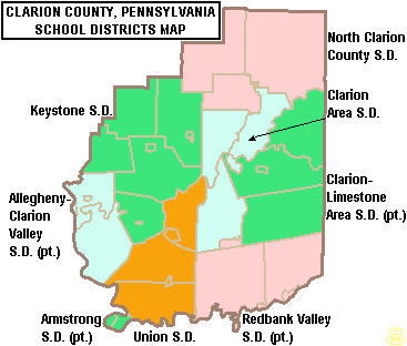 | 367 × 312 (11 KB) | Ruhrfisch | {{Information| |Description= Map of Clarion County, Pennsylvania, United States Public School Districts |Source= taken from US Census website [http://factfinder.census.gov/] and modified by User:Ruhrfisch |Date= July 2006 |Author= US Census, Ruhrfis |
| 02:28, 10 June 2006 |  | 367 × 312 (11 KB) | Ruhrfisch | {{Information| |Description= Map of Clarion County, Pennsylvania, United States Public School Districts |Source= taken from US Census website [http://factfinder.census.gov/] and modified by User:Ruhrfisch |Date= June 2006 |Author= US Census, Ruhrfis |
File usage
The following pages on the English Wikipedia use this file (pages on other projects are not listed):
- Allegheny-Clarion Valley Junior/Senior High School
- Allegheny-Clarion Valley School District
- Clarion-Limestone Area School District
- Clarion-Limestone Jr/Sr High School
- Clarion Area School District
- Clarion County, Pennsylvania
- Karns City Area School District
- Keystone Junior/Senior High School
- Keystone School District
- Lenape Technical School
- North Clarion County Junior/Senior High School
- North Clarion County School District
- Redbank Valley Junior/Senior High School
- Redbank Valley School District
- Union Junior/Senior High School (Pennsylvania)
- Union School District (Pennsylvania)
- User:Epoloch/Projects
- Template:Clarion County, Pennsylvania School Districts
Global file usage
The following other wikis use this file:
- Usage on ja.wikipedia.org