Loading
  • 21 Aug, 2019

  • By, Wikipedia

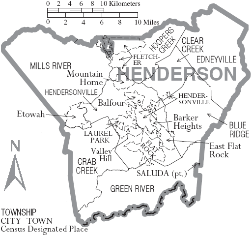
File:Map Of Henderson County North Carolina With Municipal And Township Labels.PNG

and

Public domain
This image or file is a work of a United States Census Bureau employee, taken or made as part of that person's official duties. As a work of the U.S. federal government, the image is in the public domain.

English  español  日本語  македонски  മലയാളം  português do Brasil  русский  українська  עברית  +/−

Captions

Add a one-line explanation of what this file represents

Items portrayed in this file

depicts

June 2007

File history

Click on a date/time to view the file as it appeared at that time.

Date/TimeThumbnailDimensionsUserComment
current16:37, 24 June 2007Thumbnail for version as of 16:37, 24 June 2007513 × 480 (51 KB)Ruhrfisch{{Information| |Description= Map of Henderson County, North Carolina, United States with township and municipal boundaries |Source= taken from US Census website [http://www2.census.gov/geo/maps/general_ref/cousub_outline/cen2k_pgsz/nc_cosub.pdf] and modi

The following page uses this file:

Global file usage