File:Map Of Lancaster County Pennsylvania School Districts.png
Click on a date/time to view the file as it appeared at that time.
| Date/Time | Thumbnail | Dimensions | User | Comment | |
|---|---|---|---|---|---|
| current | 01:00, 30 May 2006 | 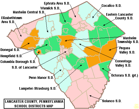 | 488 × 383 (22 KB) | Ruhrfisch | == Summary == {{Information| |Description= Map of Lancaster County, Pennsylvania, United States Public School Districts |Source= taken from US Census website [http://factfinder.census.gov/] and modified by User:Ruhrfisch |Date= May 2006 |Author= US |
| 14:58, 24 April 2006 |  | 489 × 384 (22 KB) | Ruhrfisch | {{Information| |Description= Map of Lancaster County, Pennsylvania, United States Public School Districts |Source= taken from US Census website [http://factfinder.census.gov/] and modified by User:Ruhrfisch |Date= April 2006 |Author= US Census, Ruhr | |
| 21:05, 20 April 2006 |  | 489 × 384 (23 KB) | Ruhrfisch | {{Information| |Description= Map of Lancaster County, Pennsylvania, United States Public School Districts |Source= taken from US Census website [http://factfinder.census.gov/] and modified by User:Ruhrfisch |Date= April 2006 |Author= US Census, Ruhr |
File usage
The following pages on the English Wikipedia use this file (pages on other projects are not listed):
- Cocalico School District
- Cocalico Senior High School
- Columbia Borough School District
- Conestoga Christian School
- Conestoga Valley High School
- Conestoga Valley School District
- Conrad Weiser Area School District
- Dayspring Christian Academy
- Donegal High School
- Donegal School District
- Eastern Lancaster County School District
- Elizabethtown Area School District
- Ephrata Area School District
- Ephrata High School (Pennsylvania)
- Garden Spot High School
- Hempfield High School
- Hempfield School District
- J. P. McCaskey High School
- Lampeter-Strasburg High School
- Lampeter-Strasburg School District
- Lancaster Catholic High School
- Lancaster Country Day School
- Lancaster County, Pennsylvania
- Lancaster County Christian School
- Lancaster Mennonite School
- Linden Hall (school)
- Manheim Central High School
- Manheim Central School District
- Manheim Township High School
- Manheim Township School District
- Octorara Area School District
- Octorara Junior-Senior High School
- Penn Manor High School
- Penn Manor School District
- Pequea Valley High School
- Pequea Valley School District
- Saint Leo the Great School (Pennsylvania)
- School District of Lancaster
- Solanco High School
- Solanco School District
- Warwick High School (Pennsylvania)
- Warwick School District
- Talk:Christiana, Pennsylvania
- User:Epoloch/Projects
- File talk:Map of Lancaster County Pennsylvania School Districts.png
- Template:Lancaster County, Pennsylvania School Districts
Global file usage
The following other wikis use this file:
- Usage on ja.wikipedia.org