File:Map Of Potter County Pennsylvania School Districts.png
Click on a date/time to view the file as it appeared at that time.
| Date/Time | Thumbnail | Dimensions | User | Comment | |
|---|---|---|---|---|---|
| current | 00:46, 7 November 2008 | 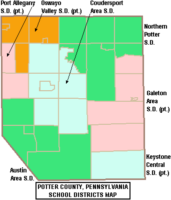 | 342 × 399 (10 KB) | Ruhrfisch | East Fork is defunct, so I removed the border between it and Whrton Township on the map. All other information is the same. |
| 01:18, 30 May 2006 |  | 342 × 399 (10 KB) | Ruhrfisch | == Summary == {{Information| |Description= Map of Potter County, Pennsylvania, United States Public School Districts |Source= taken from US Census website [http://factfinder.census.gov/] and modified by User:Ruhrfisch |Date= May 2006 |Author= US Cen | |
| 03:37, 27 April 2006 |  | 342 × 399 (10 KB) | Ruhrfisch | {{Information| |Description= Map of Potter County, Pennsylvania, United States Public School Districts |Source= taken from US Census website [http://factfinder.census.gov/] and modified by User:Ruhrfisch |Date= April 2006 |Author= US Census, Ruhrfis |
File usage
The following 14 pages use this file:
- Austin Area School District
- Austin High School (Austin, Pennsylvania)
- Central Mountain High School
- Coudersport Area Junior/Senior High School
- Coudersport Area School District
- Galeton Area School District
- Keystone Central School District
- Northern Potter Junior Senior High School
- Northern Potter School District
- Oswayo Valley High School
- Oswayo Valley School District
- Port Allegany School District
- Potter County, Pennsylvania
- Template:Potter County, Pennsylvania School Districts
Global file usage
The following other wikis use this file:
- Usage on ja.wikipedia.org
- Usage on www.wikidata.org