File:Map Of Sunda And Sahul 2.png
Source=Base map derived from File:Karte von Sunda und Sahul.png. Work of
Map of Sunda and Sahul and the Wallace Line, the Lydekker Line and the Weber Line
Click on a date/time to view the file as it appeared at that time.
| Date/Time | Thumbnail | Dimensions | User | Comment | |
|---|---|---|---|---|---|
| current | 16:08, 1 October 2012 | 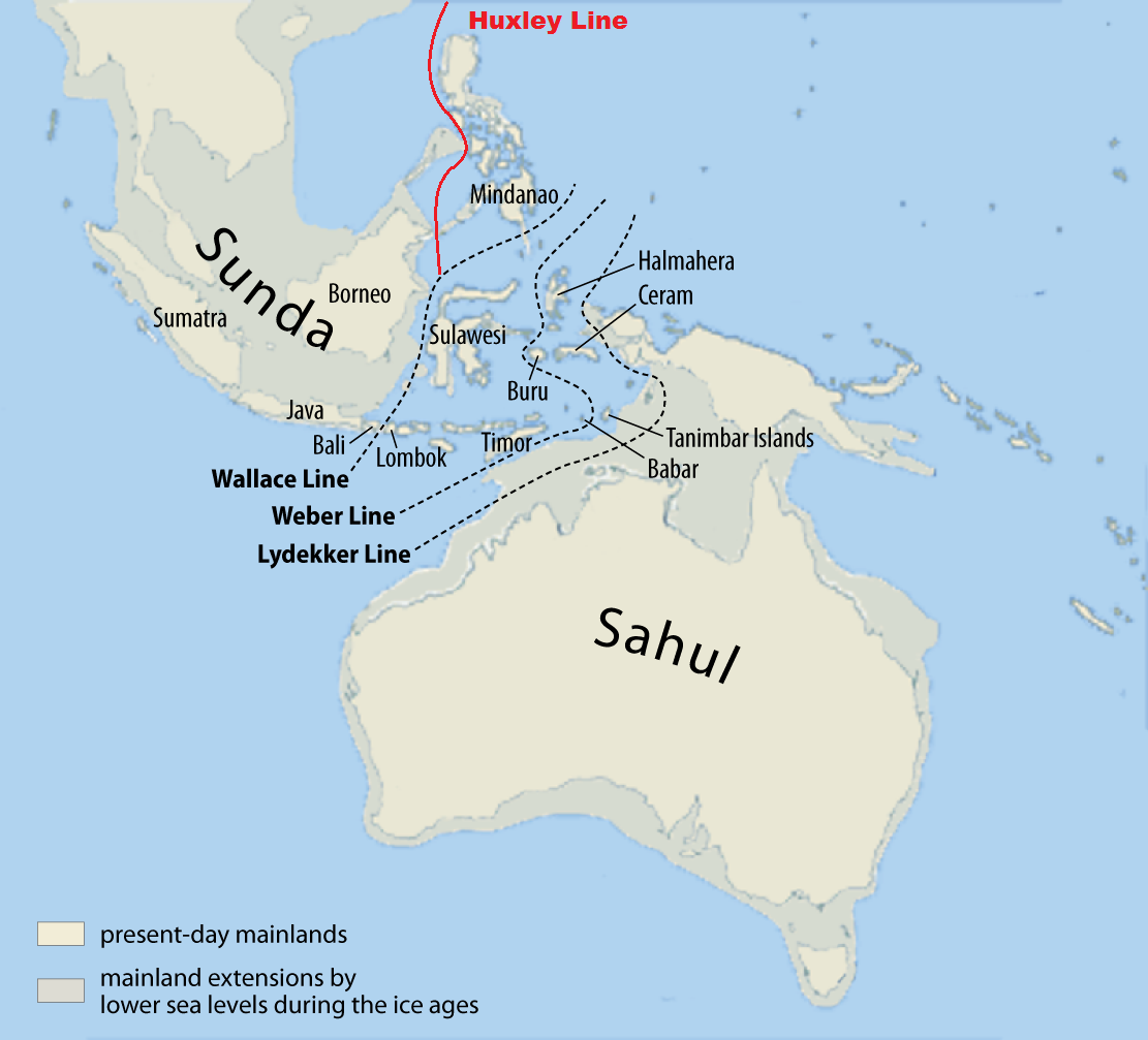 | 1,111 × 1,007 (360 KB) | Altaileopard | better description |
| 11:15, 1 October 2012 |  | 1,111 × 1,007 (363 KB) | Altaileopard | User created page with UploadWizard |
The following other wikis use this file: