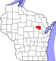
File:Map Of Wisconsin Highlighting Menominee County.svg
Click on a date/time to view the file as it appeared at that time.
| Date/Time | Thumbnail | Dimensions | User | Comment | |
|---|---|---|---|---|---|
| current | 10:52, 25 June 2024 |  | 1,055 × 1,130 (70 KB) | Nux | fix rendering (remove clipping) |
| 19:06, 24 June 2024 |  | 4,747 × 5,087 (103 KB) | Mdann52 | Upload new file to correct SVG issue | |
| 00:23, 13 February 2006 |  | 4,747 × 5,087 (103 KB) | David Benbennick | {{subst:User:Dbenbenn/clm|county=Menominee County|state=Wisconsin|type=county}} | |
| 18:17, 12 February 2006 |  | 4,747 × 5,087 (103 KB) | David Benbennick | {{subst:User:Dbenbenn/clm|county=Menominee County|state=Wisconsin|type=county}} |
File usage
The following 17 pages use this file:
- Big Injun Lake
- Keshena, Wisconsin
- Legend Lake, Wisconsin
- List of counties in Wisconsin
- Menominee County, Wisconsin
- Menominee Indian Reservation
- Middle Village, Wisconsin
- National Register of Historic Places listings in Menominee County, Wisconsin
- Neopit, Wisconsin
- Perote, Wisconsin
- Zoar, Wisconsin
- User:Nyttend/County templates/WI
- User:Rfc1394/sandbox2
- File talk:Map of Wisconsin highlighting Menominee County.svg
- Template:MenomineeCountyWI-geo-stub
- Template:Menominee County, Wisconsin
- Category:Populated places in Menominee County, Wisconsin
Global file usage
The following other wikis use this file:
- Usage on ar.wikipedia.org
- Usage on bg.wikipedia.org
- Usage on bpy.wikipedia.org
- Usage on cdo.wikipedia.org
- Usage on ceb.wikipedia.org
- Usage on ce.wikipedia.org
- Usage on cy.wikipedia.org
- Usage on de.wikipedia.org
- Usage on es.wikipedia.org
- Usage on et.wikipedia.org
- Usage on eu.wikipedia.org
- Usage on fa.wikipedia.org
- Usage on fi.wikipedia.org
- Usage on fr.wikipedia.org
- Usage on glk.wikipedia.org
- Usage on ht.wikipedia.org
- Usage on hu.wikipedia.org
- Usage on it.wikipedia.org
- Usage on ja.wikipedia.org
- Usage on ko.wikipedia.org
- Usage on la.wikipedia.org
- Usage on mzn.wikipedia.org
- Usage on nds.wikipedia.org
- Usage on nl.wikipedia.org
- Usage on pl.wikipedia.org
- Usage on pt.wikipedia.org
- Usage on ro.wikipedia.org
View more global usage of this file.