Click on a date/time to view the file as it appeared at that time.
| Date/Time | Thumbnail | Dimensions | User | Comment |
|---|
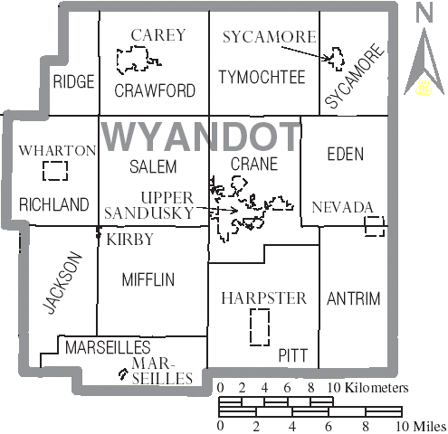
| current | 20:44, 26 June 2006 |  | 495 × 480 (34 KB) | Ruhrfisch | {{Information| |Description= Map of Wyandot County, Ohio, United States with township and municipal boundaries |Source= taken from US Census website [http://www2.census.gov/geo/maps/general_ref/cousub_outline/cen2k_pgsz/oh_cosub.pdf] and modified by [[Us |
The following pages on the English Wikipedia use this file (pages on other projects are not listed):
