This historical map image could be re-created using vector graphics as an SVG file. This has several advantages; see Commons:Media for cleanup for more information. If an SVG form of this image is available, please upload it and afterwards replace this template with {{vector version available|new image name}}.
It is recommended to name the SVG file “Map of the Holy Roman Empire, 1789 en.svg”—then the template Vector version available (or Vva) does not need the new image name parameter.
to share – to copy, distribute and transmit the work
to remix – to adapt the work
Under the following conditions:
attribution – You must give appropriate credit, provide a link to the license, and indicate if changes were made. You may do so in any reasonable manner, but not in any way that suggests the licensor endorses you or your use.
share alike – If you remix, transform, or build upon the material, you must distribute your contributions under the same or compatible license as the original.
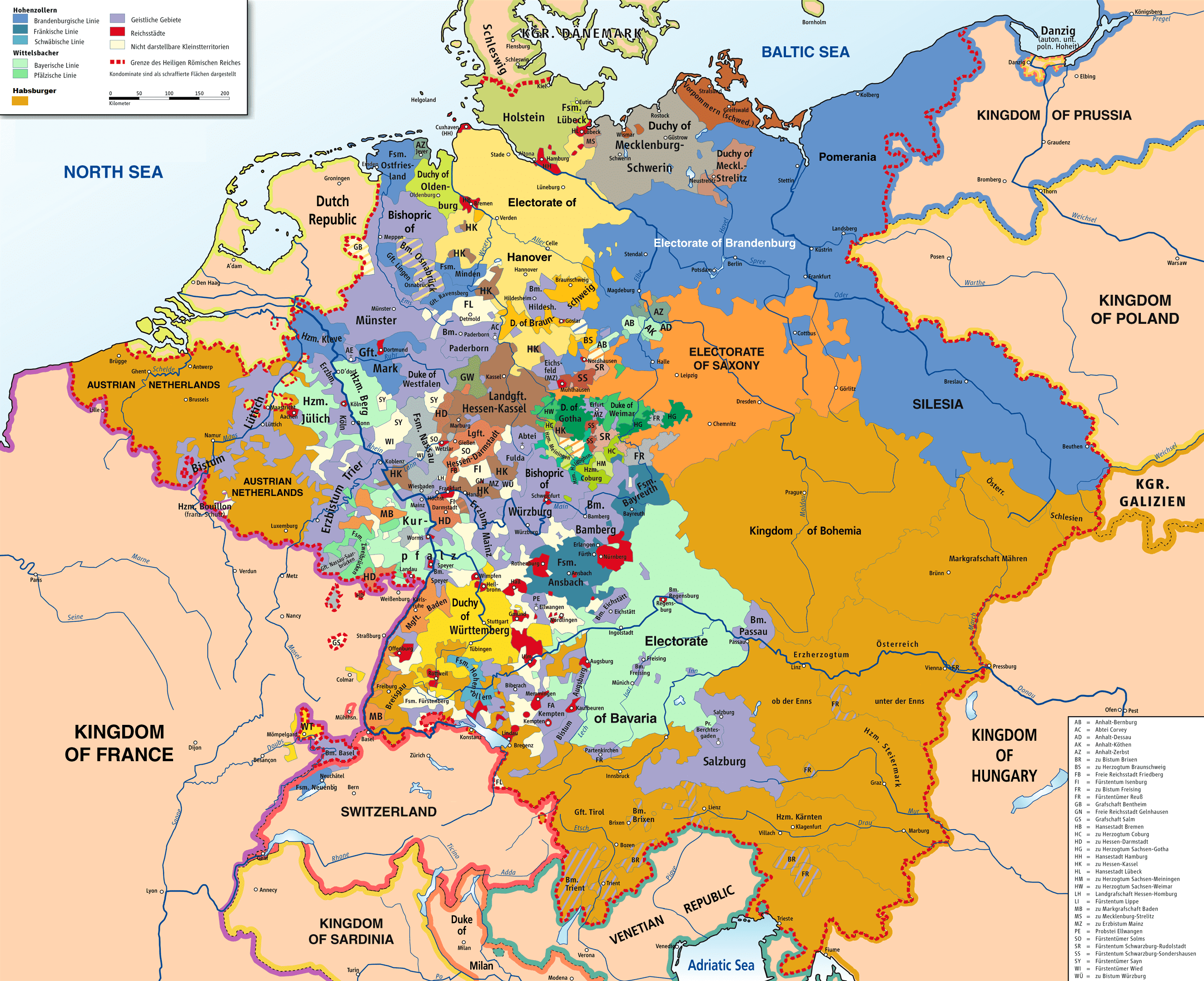
I've added a few more English place names, as follows: Wien > Vienna Muenchen > Munich Mailand > Milan Bruessel > Brussels Prag > Prague Antwerpen > Antwerp Triest > Trieste Warschau > Warsaw Gent > Ghent Erzbistum removed from Salzburg; should be Ar...
{{Information |Description={{en|1=Map of the Holy Roman Empire, 1789, translated (somewhat) from original German version on Wikipedia Commons}} |Source=Own source, translated map from Image:HRR 1789.png, also on WC |Author=Robert Alfers, [[:de:Benutzer:kg


