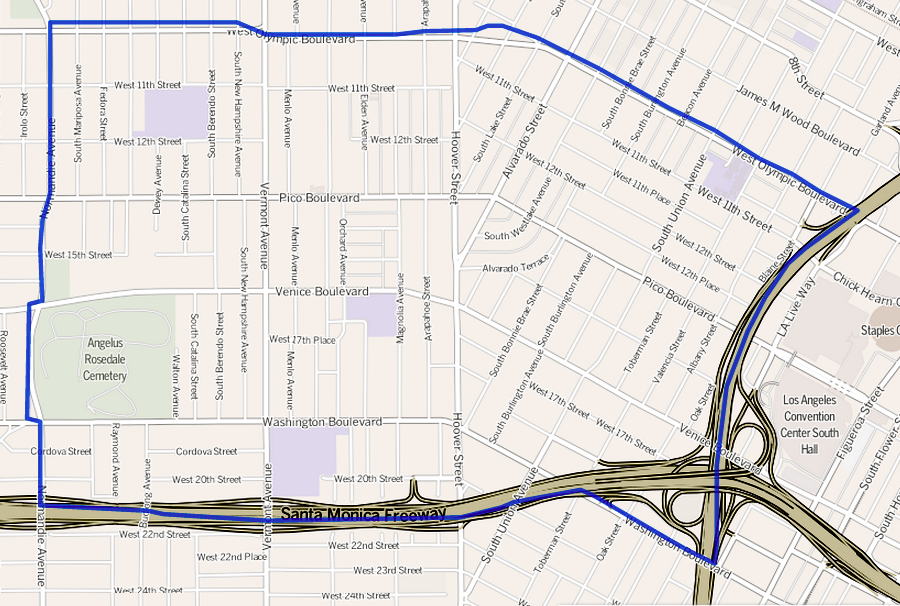
File:Map Of The Pico-Union Neighborhood Of Los Angeles, California.png
Boundary map as drawn by the Los Angeles Times on a CC-by-SA background. Note at bottom right of map on the L.A. Times website noted above says "CC-by-SA" (which gives permission to use the map). There is a link there to https://creativecommons.org/licenses/by-sa/2.0, which explains the meaning thereof. The base map is credited to http://www.openstreetmap.org/


The Times spells all this out at http://projects.latimes.com/mapping-la/about/#the-data
Licensing
This file is licensed under the Creative Commons Attribution-Share Alike 2.5 Generic license.
- You are free:
- to share – to copy, distribute and transmit the work
- to remix – to adapt the work
- Under the following conditions:
- attribution – You must give appropriate credit, provide a link to the license, and indicate if changes were made. You may do so in any reasonable manner, but not in any way that suggests the licensor endorses you or your use.
- share alike – If you remix, transform, or build upon the material, you must distribute your contributions under the same or compatible license as the original.