File:Map Of The Spanish Civil War In September 1936.png
Summary
| Description |
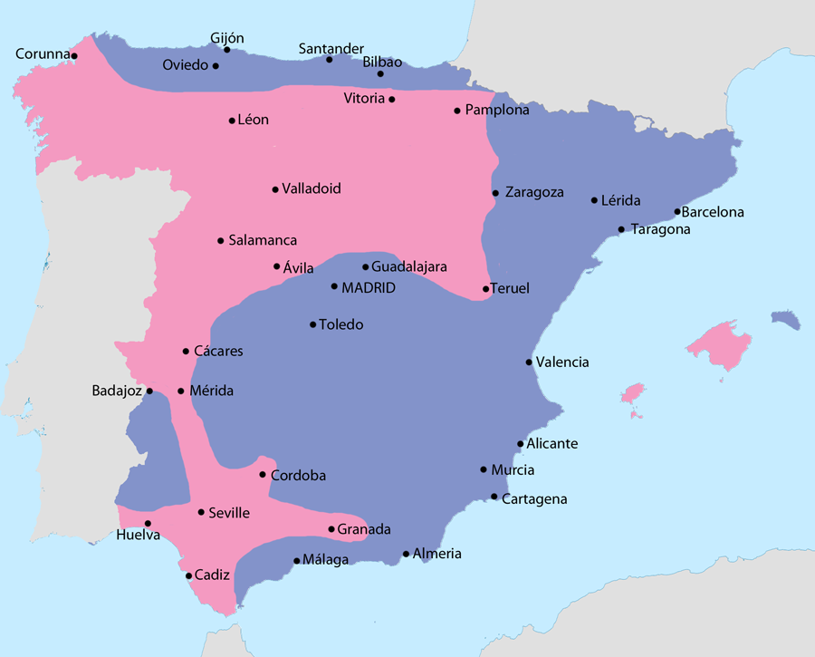
English: Map showing Spain in September 1936:
|
| Date | |
| Source | File:Iberian Peninsula location map.svg |
| Author | NordNordWest, modifications by user:Sting, Grandiose (talk) |
Licensing
This file is licensed under the Creative Commons Attribution-Share Alike 3.0 Unported license.
- You are free:
- to share – to copy, distribute and transmit the work
- to remix – to adapt the work
- Under the following conditions:
- attribution – You must give appropriate credit, provide a link to the license, and indicate if changes were made. You may do so in any reasonable manner, but not in any way that suggests the licensor endorses you or your use.
- share alike – If you remix, transform, or build upon the material, you must distribute your contributions under the same or compatible license as the original.