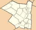
File:Map Of Towns In Ulster County, New York.svg
Click on a date/time to view the file as it appeared at that time.
| Date/Time | Thumbnail | Dimensions | User | Comment | |
|---|---|---|---|---|---|
| current | 07:07, 5 April 2011 |  | 1,475 × 1,250 (23 KB) | Monty845 | Color of other counties was off |
| 23:26, 3 April 2011 |  | 1,475 × 1,250 (23 KB) | Monty845 | expanded eastern edge further | |
| 23:22, 3 April 2011 |  | 1,425 × 1,250 (23 KB) | Monty845 | Expanded eastern edge of map to allow labeling of those counties | |
| 05:49, 3 April 2011 |  | 1,375 × 1,250 (24 KB) | Monty845 | {{Information |Description ={{en|1=This is a trace of towns located in Ulster County, New York. It is a derivative work of a map from the United States Census Bureau which is automatically part of the public domain as |
File usage
The following pages on the English Wikipedia use this file (pages on other projects are not listed):