File:MapaMacau1912.jpg
Please edit this file's description and provide a source.
This work is from an official work of Macau and is in the public domain in Macau and possibly other jurisdictions. See here for the type of material that are in the Public domain in Chinese and Portuguese (official languages of Macau), plus English (not an official language of Macau).
|
 | |
| Annotations | This image is annotated: View the annotations at Commons |
Click on a date/time to view the file as it appeared at that time.
| Date/Time | Thumbnail | Dimensions | User | Comment | |
|---|---|---|---|---|---|
| current | 09:34, 14 February 2007 | 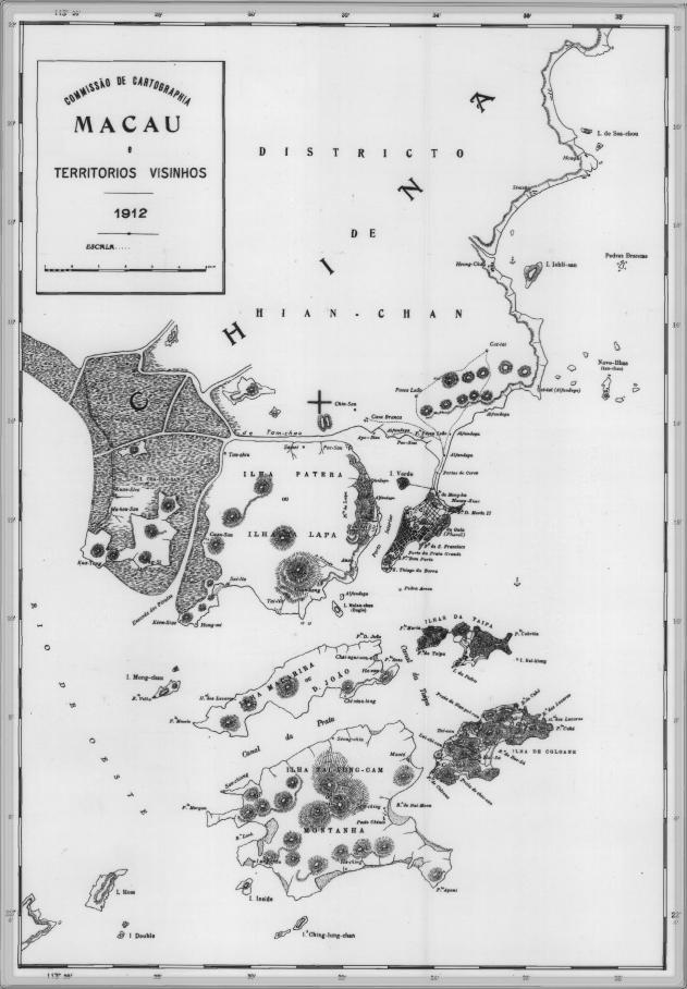 | 631 × 908 (81 KB) | AdriAg | This is a map of Macau and is surrounded territories in 1912. In that time, the Portuguese Colony of Macau is formed by the [http://pt.wikipedia.org/key/Pen%C3%ADnsula_de_Macau Peninsula de Macau], [http://pt.wikipedia.org/key/Taipa Taipa] and [http://p |
The following other wikis use this file: