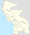
File:Mapa De La Confederación Perú-Boliviana.png
Click on a date/time to view the file as it appeared at that time.
| Date/Time | Thumbnail | Dimensions | User | Comment | |
|---|---|---|---|---|---|
| current | 01:48, 26 April 2023 |  | 559 × 600 (123 KB) | Stars415 | Agregue Puerto de Paita |
| 21:33, 16 March 2023 |  | 1,336 × 1,433 (197 KB) | Stars415 | Agregue Iquique y nombre de países limítrofes. | |
| 15:51, 11 February 2023 |  | 1,230 × 1,434 (170 KB) | Fernando6718 | Agregé Arica | |
| 19:24, 14 January 2023 |  | 1,230 × 1,434 (169 KB) | Bodoque9903 | corrijo limites entre Arequipa y Litoral | |
| 18:28, 14 January 2023 |  | 1,230 × 1,434 (171 KB) | Bodoque9903 | Uploaded own work with UploadWizard |
File usage
The following 3 pages use this file:
Global file usage
The following other wikis use this file:
- Usage on bn.wikipedia.org
- Usage on es.wikipedia.org
- Usage on qu.wikipedia.org