File:Mare Tyrrhenum Map.JPG
Transferred from
en.wikipedia to Commons by
Magnus Manske using
CommonsHelper .
The original description page was
here . All following user names refer to en.wikipedia.
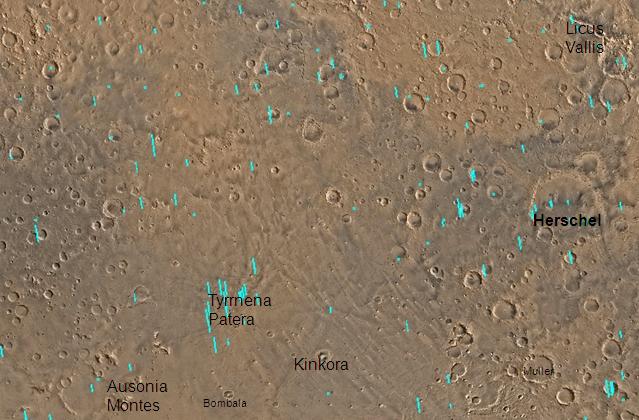
2008-12-29 19:29 Jimmarsmars 639×420× (57864 bytes) {{Information |Description=Map of Mare Tyrrhenum |Source=http:www.msss.com/moc_gallery/s05-s10/mc22.html |Date=December 29, 2008 |Author=Jim Secosky modified NASA photo. |Permission= |other_versions= }} English Add a one-line explanation of what this file represents
File history
Click on a date/time to view the file as it appeared at that time.
Date/Time Thumbnail Dimensions User Comment current 06:45, 20 February 2011 639 × 420 (57 KB) File Upload Bot (Magnus Manske) {{BotMoveToCommons|en.wikipedia|year={{subst:CURRENTYEAR}}|month={{subst:CURRENTMONTHNAME}}|day={{subst:CURRENTDAY}}}} {{Information |Description={{en|Map of Mare Tyrrhenum quadrangle with labels. The small, colored rectangles represent image footprints
File usage
The following pages on the English Wikipedia use this file (pages on other projects are not listed):
Global file usage
The following other wikis use this file:
Usage on es.wikipedia.org
Usage on it.wikipedia.org
Usage on ja.wikipedia.org
Usage on pl.wikipedia.org
Usage on pt.wikipedia.org
Usage on uk.wikipedia.org
Usage on www.wikidata.org
Usage on zh.wikipedia.org
This file contains additional information, probably added from the digital camera or scanner used to create or digitize it.
If the file has been modified from its original state, some details may not fully reflect the modified file.